Area Overview for LE9 6NX
Photos of LE9 6NX
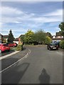
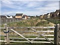
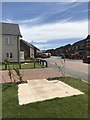
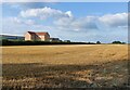
18 photos from this area
Area Information
Key information about the LE9 6NX including its size, population, and administrative classification.
- Area Type
- Postcode
- Area Size
- 2.4 hectares
- Population
- 1575
- Population Density
- 1807 people/km²
House Prices in LE9 6NX
26
Properties
£237,121
Average Sold Price
£95,000
Lowest Price
£407,500
Highest Price
Showing 26 properties
| Address | Type | Beds | Baths | Last Sale Price | Last Sale Date | |
|---|---|---|---|---|---|---|
| 5 Townsend Close, Broughton Astley, LE9 6NX | Detached | 4 | 3 | £407,500 | Jan 2025 | |
| 2 Townsend Close, Broughton Astley, LE9 6NX | Detached | 2 | - | £267,000 | Oct 2020 | |
| 24 Townsend Close, Broughton Astley, LE9 6NX | Detached | 5 | 2 | £318,000 | Oct 2019 | |
| 16 Townsend Close, Broughton Astley, LE9 6NX | Detached | 4 | 1 | £285,000 | Nov 2016 | |
| 4 Townsend Close, Broughton Astley, LE9 6NX | house | - | - | £295,000 | Aug 2015 | |
| 18 Townsend Close, Broughton Astley, LE9 6NX | Detached | 4 | - | £250,000 | Nov 2014 | |
| 25 Townsend Close, Broughton Astley, LE9 6NX | Bungalow | - | - | £175,000 | Jul 2010 | |
| 13 Townsend Close, Broughton Astley, LE9 6NX | Detached | 4 | 2 | £248,000 | Aug 2008 | |
| 17 Townsend Close, Broughton Astley, LE9 6NX | Detached | - | - | £219,950 | Jun 2003 | |
| 7 Townsend Close, Broughton Astley, LE9 6NX | Detached | - | - | £180,000 | Sep 2002 |
Page 1 of 3
Energy Efficiency in LE9 6NX
Amenities
Schools
| Rank | School | Type | Entry gender | Ages |
|---|
Explore more schools in this area
Go to Schools tabDemographics
Household Size
Family (3-5 people)
most common
Accommodation Type
Houses
most common
Tenure
90
majority
Ethnic Group
White
most common
Religion
N/A
most common
Household Composition
N/A
most common
Age
47
median
Adults (30-64 years)
most common
Household Deprivation
N/A
with no deprivation
NS-SEC
48
in Lower managerial occupations
Explore more demographic insights in this area
Go to Demographics tabPlanning
Planning Constraints
- Flood RiskPremium
- Ramsar Wetland SitesPremium
- Area of Outstanding Natural BeautyPremium
- Protected Nature ReservePremium
- Protected WoodlandPremium