Area Overview for LE9 4YJ
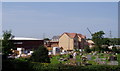
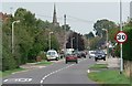
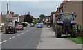
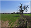
Photos of LE9 4YJ


Area Information
Living in LE9 4YJ means being part of a small, tightly knit residential cluster in England. With a population of 2,481 and a density of 1,048 people per square kilometre, the area feels compact yet functional. This postcode is ideal for those seeking a quiet, established community with easy access to local amenities. The proximity to Hinckley Railway Station and nearby primary schools makes it practical for families and commuters. Daily life here is shaped by a mature demographic, with a strong focus on homeownership and a low crime risk. The area’s safety and limited environmental constraints, such as no flood zones or protected natural sites, contribute to a stable living environment. While it lacks sprawling urban features, its small size fosters a sense of familiarity, where residents are likely to know their neighbours. For buyers, LE9 4YJ offers a blend of security, convenience, and a straightforward lifestyle, though its limited scale means it’s best suited for those prioritising proximity to essentials over expansive space.
- Area Type
- Postcode
- Area Size
- Not available
- Population
- 2481
- Population Density
- 1048 people/km²
The property market in LE9 4YJ is characterised by high home ownership, with 82% of residents owning their homes. This suggests a stable, long-term market where rental properties are less prevalent. The accommodation type is predominantly houses, which is unusual for a small postcode area but may indicate a focus on family-friendly housing. Given the limited size of the area, the housing stock is likely to be modest in scale, with properties concentrated around local amenities. Buyers should consider that the market is not highly speculative, as the area lacks major urban development or investment. The presence of nearby schools and the railway station adds to its appeal for families, though the small size means competition for properties could be keen. For those seeking a quiet, owner-occupied home with minimal environmental risk, LE9 4YJ offers a straightforward proposition.
House Prices in LE9 4YJ
No properties found in this postcode.
Energy Efficiency in LE9 4YJ
The lifestyle in LE9 4YJ is shaped by its proximity to local amenities. Within practical reach are five retail outlets, including Heart of England Co-operative Co and Co-op Croft, offering everyday shopping needs. The Hinckley Railway Station provides access to broader transport networks, enabling trips to nearby towns or cities. While the area lacks large parks or leisure facilities, the retail options suggest a focus on convenience rather than expansive recreational spaces. The presence of two primary schools adds to the community’s family-friendly appeal. Overall, daily life here is defined by simplicity and accessibility, with residents able to meet most needs locally. The small scale of the area means it’s best suited for those who prioritise proximity to essentials over sprawling amenities.
Amenities
Schools
Residents of LE9 4YJ have access to two primary schools: Manorfield Church of England Primary School Stoney Stanton and Manorfield Church of England Primary School. Both institutions cater to younger children, providing a foundation for early education within the community. The presence of two primary schools suggests a focus on family-oriented living, though no secondary schools are listed in the data. This means parents may need to look beyond the immediate area for secondary education. The availability of local primary schools is a key advantage for families with young children, reducing the need for long commutes. However, the lack of detailed information on Ofsted ratings or school performance means prospective buyers should conduct further research to assess the quality of education.
| Rank | School | Type | Entry gender | Ages |
|---|
Explore more schools in this area
Go to Schools tabDemographics
The community in LE9 4YJ is predominantly composed of adults aged 30–64, with a median age of 47. This suggests a mature, settled population, likely with established careers and families. Homeownership is high at 82%, indicating a stable housing market where most residents own their properties. The accommodation type is primarily houses, which aligns with the area’s residential character. The predominant ethnic group is White, reflecting a homogenous demographic profile. While no specific data on deprivation is provided, the high home ownership and low crime risk imply a relatively affluent and secure environment. This demographic structure supports a community focused on long-term living, with limited turnover of residents. The absence of detailed diversity metrics means the area’s social fabric is largely defined by its dominant group, which may influence local culture and social dynamics.
Household Size
Accommodation Type
Tenure
Ethnic Group
Religion
Household Composition
Age
Household Deprivation
NS-SEC
Explore more demographic insights in this area
Go to Demographics tabPlanning
Planning Constraints
- Flood RiskPremium
- Ramsar Wetland SitesPremium
- Area of Outstanding Natural BeautyPremium
- Protected Nature ReservePremium
- Protected WoodlandPremium