Area Overview for LE9 3WW
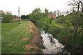
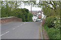
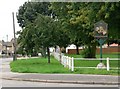
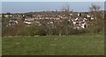
Photos of LE9 3WW
Area Information
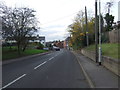
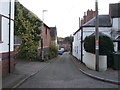
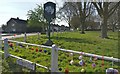
Living in LE9 3WW offers a quiet, compact residential experience in a small cluster of homes spread across England. With a population of 1,155 and a density of 75 people per square kilometre, this area feels intentionally low-key, avoiding the congestion of larger towns. The community is predominantly composed of adults aged 30–64, with a median age of 47, suggesting a stable, mature demographic. Home ownership is high at 77%, reflecting a focus on long-term residency rather than transient rental markets. Daily life here is shaped by proximity to local amenities, including two railway stations—South Wigston and Hinckley—which link residents to nearby towns. The area’s low flood risk and absence of protected natural sites mean development constraints are minimal, though this also means the landscape is unremarkable. For those prioritising safety, the crime risk score of 83/100 indicates a below-average likelihood of incidents, making it a secure place to live. Families may find the single primary school nearby sufficient for early years education, though secondary options are not listed. Overall, LE9 3WW is a modest, functional area for those seeking simplicity over spectacle.
- Area Type
- Postcode
- Area Size
- Not available
- Population
- 1155
- Population Density
- 75 people/km²
The property market in LE9 3WW is characterised by high home ownership—77% of residents own their homes—indicating a strong preference for long-term residency over rental living. The accommodation type is predominantly houses, which suggests a focus on larger, family-oriented properties rather than apartments or flats. This aligns with the area’s low population density and the absence of high-rise developments. Given the small size of the postcode and the limited number of listed properties, the housing stock is likely constrained, meaning buyers may need to look beyond LE9 3WW’s immediate boundaries for more options. The lack of planning constraints, such as protected woodlands or Areas of Outstanding Natural Beauty, may make it easier to expand housing, though this also means the landscape lacks distinctive features. For buyers, the market is likely stable but niche, with properties catering to those prioritising security, simplicity, and proximity to rail links over urban amenities.
House Prices in LE9 3WW
No properties found in this postcode.
Energy Efficiency in LE9 3WW
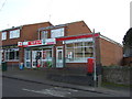
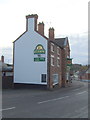
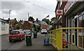
Daily life in LE9 3WW is shaped by its modest amenities, which include five retail outlets such as Spar and Tesco Narborough. These shops provide essentials like groceries and household items, reducing the need for long trips to larger centres. The two railway stations—South Wigston and Hinckley—offer access to nearby towns, enhancing connectivity for shopping, work, or leisure. However, the data does not mention parks, leisure facilities, or dining options, suggesting the area’s character is defined by simplicity rather than vibrant social hubs. For residents, the convenience of local retail and rail links balances the absence of more expansive amenities. The low population density and small scale of the area mean it is unlikely to host large-scale events or cultural venues, making it ideal for those seeking a low-key, self-sufficient lifestyle.
Amenities
Schools
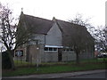
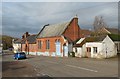
The nearest school to LE9 3WW is Thurlaston Church of England Primary School, which serves the local community with a primary education offering. Rated ‘good’ by Ofsted, it provides a solid foundation for young children, though no secondary schools are listed in the data. This means families with older children may need to look further afield for secondary education options, potentially increasing commuting distances. The single primary school suggests a limited choice for early years education, but its ‘good’ rating indicates it meets acceptable standards. For parents prioritising proximity, this school is a practical option, but those requiring a full range of educational stages may need to consider nearby towns like Hinckley or Leicester. The absence of other schools in the area underscores the small scale of LE9 3WW’s residential cluster.
| Rank | School | Type | Entry gender | Ages |
|---|
Explore more schools in this area
Go to Schools tabDemographics
The community in LE9 3WW is defined by its age profile and ownership patterns. With a median age of 47 and 77% of residents owning their homes, the area is dominated by adults in their 30s to 60s, many of whom have established long-term roots. The predominant accommodation type is houses, which aligns with the high home ownership rate and suggests a preference for family-sized properties. Ethnically, the population is predominantly White, though no specific data on diversity or minority representation is provided. The age distribution—peaking in the 30–64 range—implies a workforce-centric demographic, with fewer young families or retirees. This profile may influence local services, such as the single primary school listed, which caters to younger children but lacks secondary options. The absence of deprivation data means it is unclear how economic pressures or inequalities shape daily life, but the low crime risk and stable housing market suggest a generally secure environment for residents.
Household Size
Accommodation Type
Tenure
Ethnic Group
Religion
Household Composition
Age
Household Deprivation
NS-SEC
Explore more demographic insights in this area
Go to Demographics tabPlanning
Planning Constraints
- Flood RiskPremium
- Ramsar Wetland SitesPremium
- Area of Outstanding Natural BeautyPremium
- Protected Nature ReservePremium
- Protected WoodlandPremium