Area Overview for LE9 3GL
Photos of LE9 3GL
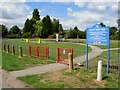
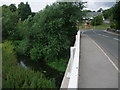
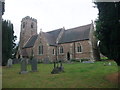
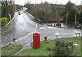
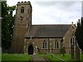
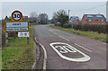
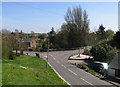
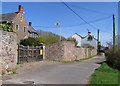
67 photos from this area
Area Information
Key information about the LE9 3GL including its size, population, and administrative classification.
- Area Type
- Postcode
- Area Size
- 1.9 hectares
- Population
- 1213
- Population Density
- 900 people/km²
House Prices in LE9 3GL
50
Properties
£186,597
Average Sold Price
£58,500
Lowest Price
£335,000
Highest Price
Showing 50 properties
| Address | Type | Beds | Baths | Last Sale Price | Last Sale Date | |
|---|---|---|---|---|---|---|
| 64 Brookes Avenue, Croft, LE9 3GL | Bungalow | 3 | 1 | £335,000 | Aug 2025 | |
| 109 Brookes Avenue, Croft, LE9 3GL | Terraced | 3 | 2 | £220,500 | Mar 2025 | |
| 90 Brookes Avenue, Croft, LE9 3GL | Terraced | 3 | 1 | £222,500 | Apr 2023 | |
| 59 Brookes Avenue, Croft, LE9 3GL | Bungalow | - | - | £198,000 | Apr 2021 | |
| 53 Brookes Avenue, Croft, LE9 3GL | Bungalow | - | - | £212,000 | Jan 2021 | |
| 84 Brookes Avenue, Croft, LE9 3GL | Terraced | 3 | 1 | £200,000 | Dec 2020 | |
| 70 Brookes Avenue, Croft, LE9 3GL | Bungalow | 2 | 1 | £225,000 | Oct 2020 | |
| 103 Brookes Avenue, Croft, LE9 3GL | Terraced | 2 | 1 | £180,000 | Mar 2019 | |
| 107 Brookes Avenue, Croft, LE9 3GL | Terraced | 2 | - | £115,000 | Feb 2016 | |
| 57 Brookes Avenue, Croft, LE9 3GL | Bungalow | 3 | - | £230,600 | Jan 2016 |
Page 1 of 5
Energy Efficiency in LE9 3GL
Amenities
Schools
| Rank | School | Type | Entry gender | Ages |
|---|
Explore more schools in this area
Go to Schools tabDemographics
Household Size
Two person
most common
Accommodation Type
Houses
most common
Tenure
76
majority
Ethnic Group
White
most common
Religion
N/A
most common
Household Composition
N/A
most common
Age
47
median
Adults (30-64 years)
most common
Household Deprivation
N/A
with no deprivation
NS-SEC
30
in Lower managerial occupations
Explore more demographic insights in this area
Go to Demographics tabPlanning
Planning Constraints
- Flood RiskPremium
- Ramsar Wetland SitesPremium
- Area of Outstanding Natural BeautyPremium
- Protected Nature ReservePremium
- Protected WoodlandPremium