Area Overview for LE9 3GF
Photos of LE9 3GF
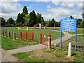
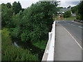
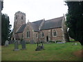
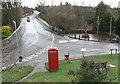

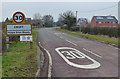
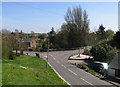
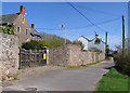
67 photos from this area
Area Information
Key information about the LE9 3GF including its size, population, and administrative classification.
- Area Type
- Postcode
- Area Size
- 1.3 hectares
- Population
- 1213
- Population Density
- 900 people/km²
House Prices in LE9 3GF
26
Properties
£183,432
Average Sold Price
£49,200
Lowest Price
£287,000
Highest Price
Showing 26 properties
| Address | Type | Beds | Baths | Last Sale Price | Last Sale Date | |
|---|---|---|---|---|---|---|
| 9 Bala Road, Croft, LE9 3GF | Semi-detached | 3 | 2 | £250,000 | Aug 2023 | |
| 17 Bala Road, Croft, LE9 3GF | house | - | - | £260,000 | Feb 2022 | |
| 28 Bala Road, Croft, LE9 3GF | house | 4 | - | £274,000 | Jul 2020 | |
| 3 Bala Road, Croft, LE9 3GF | Semi-detached | 5 | - | £222,500 | Jul 2018 | |
| 8 Bala Road, Croft, LE9 3GF | house | - | - | £168,000 | Mar 2013 | |
| 10 Bala Road, Croft, LE9 3GF | house | - | - | £169,950 | Mar 2013 | |
| 5 Bala Road, Croft, LE9 3GF | Semi-detached | - | - | £178,000 | Jun 2012 | |
| 21 Bala Road, Croft, LE9 3GF | Bungalow | 2 | - | £185,000 | Jun 2010 | |
| 22 Bala Road, Croft, LE9 3GF | Detached | - | - | £287,000 | Aug 2007 | |
| 12 Bala Road, Croft, LE9 3GF | Semi-detached | - | - | £173,000 | Jan 2006 |
Page 1 of 3
Energy Efficiency in LE9 3GF
Amenities
Schools
| Rank | School | Type | Entry gender | Ages |
|---|
Explore more schools in this area
Go to Schools tabDemographics
Household Size
Two person
most common
Accommodation Type
Houses
most common
Tenure
76
majority
Ethnic Group
White
most common
Religion
N/A
most common
Household Composition
N/A
most common
Age
47
median
Adults (30-64 years)
most common
Household Deprivation
N/A
with no deprivation
NS-SEC
30
in Lower managerial occupations
Explore more demographic insights in this area
Go to Demographics tabPlanning
Planning Constraints
- Flood RiskPremium
- Ramsar Wetland SitesPremium
- Area of Outstanding Natural BeautyPremium
- Protected Nature ReservePremium
- Protected WoodlandPremium