Area Overview for LE9 2BP
Photos of LE9 2BP
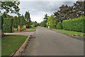
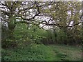

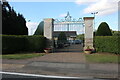
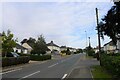
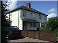
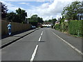
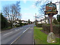
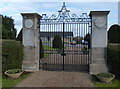
11 photos from this area
Area Information
Key information about the LE9 2BP including its size, population, and administrative classification.
- Area Type
- Postcode
- Area Size
- 28.8 hectares
- Population
- 1605
- Population Density
- 690 people/km²
House Prices in LE9 2BP
30
Properties
£865,464
Average Sold Price
£179,000
Lowest Price
£1,600,000
Highest Price
Showing 30 properties
| Address | Type | Beds | Baths | Last Sale Price | Last Sale Date | |
|---|---|---|---|---|---|---|
| Little Stocking, Links Road, Kirby Muxloe, LE9 2BP | house | 4 | 2 | £895,000 | Dec 2024 | |
| Links View, Links Road, Kirby Muxloe, LE9 2BP | house | - | - | £1,050,000 | May 2022 | |
| The Gables, Links Road, Kirby Muxloe, LE9 2BP | house | - | - | £1,050,000 | Jun 2021 | |
| Priorswood, Links Road, Kirby Muxloe, LE9 2BP | house | - | - | £840,000 | Mar 2021 | |
| The Coppins, Links Road, Kirby Muxloe, LE9 2BP | house | - | - | £1,250,000 | Mar 2020 | |
| Bramcotes, Links Road, Kirby Muxloe, LE9 2BP | Bungalow | - | - | £475,000 | Jan 2020 | |
| Willow Lodge, Links Road, Kirby Muxloe, LE9 2BP | Bungalow | 4 | - | £860,000 | Aug 2018 | |
| The Beeches, Links Road, Kirby Muxloe, LE9 2BP | Bungalow | 4 | - | £1,225,000 | Aug 2017 | |
| Hammondsfield, Links Road, Kirby Muxloe, LE9 2BP | house | - | - | £1,600,000 | Sep 2015 | |
| Spion Lodge, Links Road, Kirby Muxloe, LE9 2BP | house | 4 | - | £660,000 | Jul 2011 |
Page 1 of 3
Energy Efficiency in LE9 2BP
Amenities
Schools
| Rank | School | Type | Entry gender | Ages |
|---|
Explore more schools in this area
Go to Schools tabDemographics
Household Size
Two person
most common
Accommodation Type
Houses
most common
Tenure
75
majority
Ethnic Group
White
most common
Religion
N/A
most common
Household Composition
N/A
most common
Age
47
median
Adults (30-64 years)
most common
Household Deprivation
N/A
with no deprivation
NS-SEC
45
in Lower managerial occupations
Explore more demographic insights in this area
Go to Demographics tabPlanning
Planning Constraints
- Flood RiskPremium
- Ramsar Wetland SitesPremium
- Area of Outstanding Natural BeautyPremium
- Protected Nature ReservePremium
- Protected WoodlandPremium