Area Overview for LE9 1ZS
Photos of LE9 1ZS


Area Information
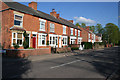
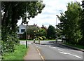
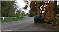
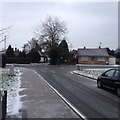
Living in LE9 1ZS means being part of a compact, residential postcode area with a population of 1,531 people spread across 201 residents per square kilometre. This small cluster of homes is typical of a quiet, close-knit neighbourhood where daily life is shaped by proximity to local amenities and a stable community. The area is characterised by its modest size, which makes it easy to navigate on foot or by bike. With no major landmarks or commercial hubs nearby, LE9 1ZS offers a low-key lifestyle, ideal for those seeking simplicity over urban bustle. The population density suggests a balance between private space and communal interaction, while the absence of large-scale developments ensures a consistent, unchanging local environment. Residents here are likely to value privacy, convenience, and the ease of accessing nearby essentials. The area’s small footprint also means that most needs—whether shopping, transport, or leisure—are within a short distance, fostering a self-contained way of living.
- Area Type
- Postcode
- Area Size
- Not available
- Population
- 1531
- Population Density
- 201 people/km²
The property market in LE9 1ZS is largely owner-occupied, with 70% of homes owned by residents rather than rented out. The accommodation type is predominantly houses, which suggests a focus on family homes or single-family dwellings. This contrasts with areas where flats or apartments dominate, and indicates a market more suited to those seeking long-term stability rather than investment. The small size of the area means that the housing stock is limited, which could make the local property market less competitive but also less dynamic. Buyers should consider that the availability of properties is constrained by the area’s compact nature, and that the majority of homes are already in private hands. For those looking to purchase, the emphasis on houses may appeal to buyers prioritising space and privacy over proximity to city centres.
House Prices in LE9 1ZS
No properties found in this postcode.
Energy Efficiency in LE9 1ZS
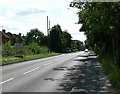
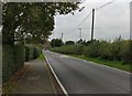
The lifestyle in LE9 1ZS is shaped by its proximity to retail and transport hubs. Within practical reach are five retail venues, including multiple Co-op stores at Whetstone, offering everyday shopping convenience. The presence of these shops ensures that residents can access groceries, household items, and other essentials without long journeys. The South Wigston Railway Station adds to the area’s accessibility, connecting residents to broader networks for commuting or leisure. While the data does not mention parks or leisure facilities, the compact nature of the area suggests that local amenities are prioritised for immediate use. The mix of retail options and transport links creates a functional, self-sufficient environment, where daily needs are met without the need for extensive travel.
Amenities
Schools
The only school listed near LE9 1ZS is Brooke House Day School, an independent institution with an Ofsted rating of satisfactory. As an independent school, it is likely to offer specialist education or niche curricula, though the satisfactory rating indicates that it meets basic standards without outstanding performance. The absence of other schools in the data means that families relying on state education may need to look beyond the immediate area for options. For those prioritising independent schooling, Brooke House provides a local alternative, though its performance suggests that parents may need to supplement with additional resources or consider other institutions nearby. The single-school focus highlights the limited educational infrastructure in the area, which could be a consideration for families with multiple children or specific educational needs.
| Rank | School | Type | Entry gender | Ages |
|---|
Explore more schools in this area
Go to Schools tabDemographics
The community in LE9 1ZS is predominantly composed of adults aged 30 to 64, with a median age of 47. This suggests a mature, established population, likely with long-term ties to the area. Home ownership is high, at 70%, indicating a strong presence of owner-occupied properties rather than rentals. The accommodation type is primarily houses, which aligns with the demographic profile of older, settled residents. The predominant ethnic group is White, reflecting a homogenous population with no significant mention of diversity in the data. The absence of specific deprivation statistics means that quality of life here is likely shaped by the stability of home ownership and the age profile of residents. With no data on income distribution or social deprivation, the focus remains on the tangible factors of age, property type, and ownership patterns.
Household Size
Accommodation Type
Tenure
Ethnic Group
Religion
Household Composition
Age
Household Deprivation
NS-SEC
Explore more demographic insights in this area
Go to Demographics tabPlanning
Planning Constraints
- Flood RiskPremium
- Ramsar Wetland SitesPremium
- Area of Outstanding Natural BeautyPremium
- Protected Nature ReservePremium
- Protected WoodlandPremium