Area Overview for LE9 1TB
Photos of LE9 1TB
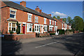
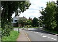
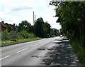
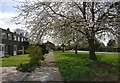
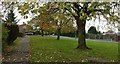
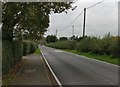
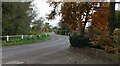
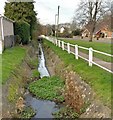
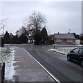

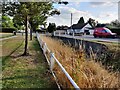
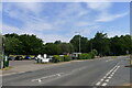
28 photos from this area
Area Information
Key information about the LE9 1TB including its size, population, and administrative classification.
- Area Type
- Postcode
- Area Size
- 10.1 hectares
- Population
- 1614
- Population Density
- 2360 people/km²
House Prices in LE9 1TB
33
Properties
£219,997
Average Sold Price
£49,000
Lowest Price
£380,000
Highest Price
Showing 33 properties
| Address | Type | Beds | Baths | Last Sale Price | Last Sale Date | |
|---|---|---|---|---|---|---|
| 41 Narborough Road, Cosby, LE9 1TB | Terraced | 2 | 1 | £250,000 | May 2024 | |
| 101 Narborough Road, Cosby, LE9 1TB | house | 4 | 2 | £380,000 | Jul 2023 | |
| 73 Narborough Road, Cosby, LE9 1TB | house | - | - | £380,000 | Oct 2022 | |
| 25 Narborough Road, Cosby, LE9 1TB | house | - | - | £275,000 | Sep 2022 | |
| 39 Narborough Road, Cosby, LE9 1TB | Terraced | 3 | - | £266,000 | Aug 2022 | |
| 71 Narborough Road, Cosby, LE9 1TB | house | 5 | - | £365,000 | Dec 2020 | |
| 33 Narborough Road, Cosby, LE9 1TB | house | - | - | £220,000 | Sep 2019 | |
| 47 Narborough Road, Cosby, LE9 1TB | house | - | - | £135,000 | Feb 2007 | |
| 23 Narborough Road, Cosby, LE9 1TB | Terraced | - | - | £150,000 | Mar 2005 | |
| 77 Narborough Road, Cosby, LE9 1TB | Detached | - | - | £240,000 | Nov 2004 |
Page 1 of 4
Energy Efficiency in LE9 1TB
Amenities
Schools
| Rank | School | Type | Entry gender | Ages |
|---|
Explore more schools in this area
Go to Schools tabDemographics
Household Size
Two person
most common
Accommodation Type
Houses
most common
Tenure
83
majority
Ethnic Group
White
most common
Religion
N/A
most common
Household Composition
N/A
most common
Age
47
median
Adults (30-64 years)
most common
Household Deprivation
N/A
with no deprivation
NS-SEC
37
in Lower managerial occupations
Explore more demographic insights in this area
Go to Demographics tabPlanning
Planning Constraints
- Flood RiskPremium
- Ramsar Wetland SitesPremium
- Area of Outstanding Natural BeautyPremium
- Protected Nature ReservePremium
- Protected WoodlandPremium