Area Overview for LE8 8AQ
Photos of LE8 8AQ
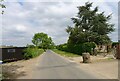
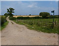
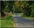
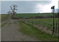
16 photos from this area
Area Information
Key information about the LE8 8AQ including its size, population, and administrative classification.
- Area Type
- Postcode
- Area Size
- 1.7 km²
- Population
- 1986
- Population Density
- 531 people/km²
House Prices in LE8 8AQ
8
Properties
£769,714
Average Sold Price
£136,000
Lowest Price
£2,400,000
Highest Price
Showing 8 properties
| Address | Type | Beds | Baths | Last Sale Price | Last Sale Date | |
|---|---|---|---|---|---|---|
| Rowley Fields Farm, Arnesby Road, Fleckney, LE8 8AQ | Detached | 8 | 8 | £2,400,000 | Jun 2024 | |
| Glebe Farm, Arnesby Road, Fleckney, LE8 8AQ | house | - | - | £720,000 | Sep 2018 | |
| The Elms Farm, Arnesby Road, Fleckney, LE8 8AQ | Farm | - | - | £600,000 | Sep 2017 | |
| Little Elms, Arnesby Road, Fleckney, LE8 8AQ | house | - | - | £167,000 | Mar 2015 | |
| Glebe Barn, Arnesby Road, Fleckney, LE8 8AQ | Detached | 4 | 6 | £675,000 | Jun 2014 | |
| The Grange, Arnesby Road, Fleckney, LE8 8AQ | Semi-detached | 2 | 1 | £690,000 | Sep 2000 | |
| Birdcage Cottage, Arnesby Road, Fleckney, LE8 8AQ | Semi-detached | - | - | £136,000 | Feb 1995 | |
| The Forge, Birdcage Cottage, Arnesby Road, Fleckney, LE8 8AQ | Flat | - | - | - | - |
Energy Efficiency in LE8 8AQ
Amenities
Schools
| Rank | School | Type | Entry gender | Ages |
|---|
Explore more schools in this area
Go to Schools tabDemographics
Household Size
Family (3-5 people)
most common
Accommodation Type
Houses
most common
Tenure
75
majority
Ethnic Group
White
most common
Religion
N/A
most common
Household Composition
N/A
most common
Age
47
median
Adults (30-64 years)
most common
Household Deprivation
N/A
with no deprivation
NS-SEC
38
in Lower managerial occupations
Explore more demographic insights in this area
Go to Demographics tabPlanning
Planning Constraints
- Flood RiskPremium
- Ramsar Wetland SitesPremium
- Area of Outstanding Natural BeautyPremium
- Protected Nature ReservePremium
- Protected WoodlandPremium