Area Overview for LE8 5WJ
Photos of LE8 5WJ
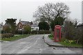
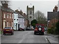
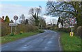
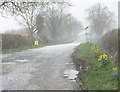

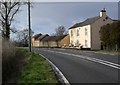
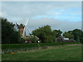
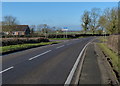
30 photos from this area
Area Information
Key information about the LE8 5WJ including its size, population, and administrative classification.
- Area Type
- Postcode
- Area Size
- 33.3 hectares
- Population
- 2351
- Population Density
- 53 people/km²
House Prices in LE8 5WJ
45
Properties
£422,454
Average Sold Price
£74,000
Lowest Price
£1,225,000
Highest Price
Showing 45 properties
| Address | Type | Beds | Baths | Last Sale Price | Last Sale Date | |
|---|---|---|---|---|---|---|
| The Oak House, St Peters Road, Arnesby, LE8 5WJ | house | 4 | - | £1,225,000 | Aug 2025 | |
| The Cottage, St Peters Road, Arnesby, LE8 5WJ | Land | 3 | 2 | £355,000 | Jun 2025 | |
| Holmleigh, St Peters Road, Arnesby, LE8 5WJ | Bungalow | 3 | - | £405,000 | Jul 2024 | |
| Bumble Bee Cottage, St Peters Road, Arnesby, LE8 5WJ | Cottage | 2 | 1 | £240,000 | Apr 2021 | |
| Longeaves, St Peters Road, Arnesby, LE8 5WJ | Bungalow | 4 | - | £550,000 | Apr 2021 | |
| Tree Tops, St Peters Road, Arnesby, LE8 5WJ | Bungalow | - | - | £400,000 | Mar 2021 | |
| Homestead Farm, St Peters Road, Arnesby, LE8 5WJ | Detached | 4 | 2 | £460,000 | Dec 2019 | |
| Old Shoulder House, St Peters Road, Arnesby, LE8 5WJ | Land | 4 | - | £620,000 | Sep 2018 | |
| The Walnuts, St Peters Road, Arnesby, LE8 5WJ | Detached | 5 | 2 | £550,000 | Jul 2018 | |
| Ashbourne, St Peters Road, Arnesby, LE8 5WJ | house | - | - | £460,000 | Nov 2017 |
Page 1 of 5
Energy Efficiency in LE8 5WJ
Amenities
Schools
| Rank | School | Type | Entry gender | Ages |
|---|
Explore more schools in this area
Go to Schools tabDemographics
Household Size
Two person
most common
Accommodation Type
Houses
most common
Tenure
84
majority
Ethnic Group
White
most common
Religion
N/A
most common
Household Composition
N/A
most common
Age
47
median
Adults (30-64 years)
most common
Household Deprivation
N/A
with no deprivation
NS-SEC
43
in Lower managerial occupations
Explore more demographic insights in this area
Go to Demographics tabPlanning
Planning Constraints
- Flood RiskPremium
- Ramsar Wetland SitesPremium
- Area of Outstanding Natural BeautyPremium
- Protected Nature ReservePremium
- Protected WoodlandPremium