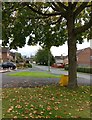
Area Overview for LE8 4BP
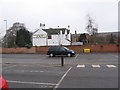
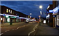
Photos of LE8 4BP


Area Information
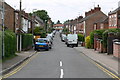
LE8 4BP is a small, tightly knit residential postcode in England, home to 1913 people spread across a compact area with a population density of 766 people per square kilometre. This is a community where homes are predominantly owner-occupied, with 70% of residents living in their own properties. The area’s demographic profile suggests a mature population, with a median age of 47 and the majority of residents falling within the 30-64 age range. Daily life here is shaped by proximity to essential services, including retail outlets, rail links, and a nearby airport. While the area lacks large-scale infrastructure, its compact size fosters a sense of familiarity. Residents benefit from a balance of practical amenities and a relatively low risk of environmental hazards, though crime rates are average. For those seeking a stable, community-focused environment with access to local facilities, LE8 4BP offers a blend of practicality and quiet living.
- Area Type
- Postcode
- Area Size
- Not available
- Population
- 1913
- Population Density
- 766 people/km²
The property market in LE8 4BP is characterised by a high rate of home ownership—70% of residents live in their own homes. This suggests a market skewed towards owner-occupation rather than rental, which may indicate a preference for long-term stability in the area. The accommodation type is predominantly houses, reflecting a small, residential cluster with limited high-density development. For buyers, this means the housing stock is likely to consist of family homes and smaller properties, with fewer apartments or commercial units. The compact nature of the postcode means the immediate surroundings offer a limited selection of properties, which could make the market competitive for those seeking specific characteristics. However, the absence of planning constraints or protected sites may simplify the buying process, though buyers should consider the area’s average crime rate and practical amenities when evaluating its appeal.
House Prices in LE8 4BP
No properties found in this postcode.
Energy Efficiency in LE8 4BP
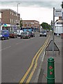
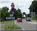
Residents of LE8 4BP have access to a range of practical amenities within easy reach. The area is served by five retail outlets, including Morrisons Daily Leicester, Iceland Blaby, and Aldi Blaby, ensuring everyday shopping needs are met. Nearby rail stations—South Wigston and Leicester—connect the area to broader networks, while Leicester Airport provides direct access to regional and international travel. Though the area is small, these amenities contribute to a convenient lifestyle, balancing local convenience with regional connectivity. The presence of retail options and transport links suggests a community that prioritises accessibility without relying on large-scale infrastructure. For those valuing self-sufficiency and ease of movement, LE8 4BP offers a pragmatic blend of local services and external links.
Amenities
Schools
The nearest school to LE8 4BP is Blaby Thistly Meadow Primary School, a primary institution with a good Ofsted rating. This school serves the local community, providing education for younger children in the area. The absence of secondary schools or further education institutions in the immediate vicinity means families may need to look beyond LE8 4BP for secondary schooling. However, the good rating at the primary level suggests a reliable foundation for early education. For parents prioritising strong primary schooling, this is a positive factor, though the lack of secondary options could influence decisions about long-term residency. The school’s presence also contributes to the area’s community cohesion, offering a focal point for local families.
| Rank | School | Type | Entry gender | Ages |
|---|
Explore more schools in this area
Go to Schools tabDemographics
The population of LE8 4BP is predominantly composed of adults aged 30-64, with a median age of 47. This suggests a community focused on middle-aged households, likely with established careers and families. Home ownership is high at 70%, indicating a stable housing market where most residents live in their own homes rather than renting. The accommodation type is primarily houses, which aligns with the area’s small-scale residential character. The predominant ethnic group is White, though specific data on diversity or deprivation is not provided. The population density of 766 people per square kilometre implies a mix of single-family homes and modest housing stock. For quality of life, the absence of significant deprivation data suggests a baseline of stability, though the average age and ownership rates point to a community that prioritises long-term residency over transient living.
Household Size
Accommodation Type
Tenure
Ethnic Group
Religion
Household Composition
Age
Household Deprivation
NS-SEC
Explore more demographic insights in this area
Go to Demographics tabPlanning
Planning Constraints
- Flood RiskPremium
- Ramsar Wetland SitesPremium
- Area of Outstanding Natural BeautyPremium
- Protected Nature ReservePremium
- Protected WoodlandPremium