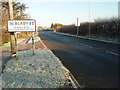
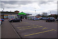
Area Overview for LE8 3XD
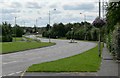
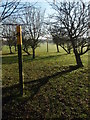
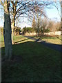
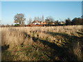
Photos of LE8 3XD


Area Information
Living in LE8 3XD offers a quiet, residential experience within a small cluster of homes. With a population of 2122, the area is compact yet well-served by nearby amenities. The community is predominantly middle-aged, with a median age of 47 and most residents falling between 30 and 64 years. This suggests a stable, established demographic, with 90% of homes owned outright rather than rented. The area is defined by its housing stock—primarily single-family homes—creating a sense of permanence. Residents benefit from proximity to retail hubs like Co-op Whetstone and Asda Leicester, as well as rail links at South Wigston and Leicester stations. Daily life here balances local convenience with easy access to broader networks, making it suitable for those prioritising security, community stability, and practical living. The low crime risk score of 85 further reinforces the area’s appeal as a safe, low-maintenance environment.
- Area Type
- Postcode
- Area Size
- Not available
- Population
- 2122
- Population Density
- 5672 people/km²
The property market in LE8 3XD is dominated by owner-occupied homes, with 90% of properties owned outright. This high ownership rate points to a community that values long-term investment and stability. The accommodation type is exclusively houses, which is unusual for areas with higher rental prevalence. This suggests a focus on family homes, likely with larger gardens or more spacious layouts. Given the small size of the postcode area, the housing stock is limited, but the high ownership rate implies a mature market with fewer turnover pressures. Buyers should consider the surrounding areas for broader options, though the immediate vicinity offers a cohesive, established environment. The absence of flats or rental properties indicates a niche market, potentially appealing to those seeking traditional, low-maintenance housing.
House Prices in LE8 3XD
No properties found in this postcode.
Energy Efficiency in LE8 3XD
The lifestyle in LE8 3XD is shaped by its proximity to retail and transport hubs. Within practical reach are five retail venues, including Co-op Whetstone and Asda Leicester, offering everyday shopping needs. These locations provide convenience for groceries, household items, and other essentials. The two nearby rail stations—South Wigston and Leicester—enhance mobility, allowing easy access to city centres, employment zones, or leisure destinations. While the area lacks detailed data on parks or leisure facilities, the retail and transport infrastructure suggests a focus on practicality over expansive recreational spaces. Residents can enjoy a straightforward, efficient lifestyle with minimal need to travel far for basic amenities.
Amenities
Schools
| Rank | School | Type | Entry gender | Ages |
|---|
Explore more schools in this area
Go to Schools tabDemographics
The community in LE8 3XD is characterised by a median age of 47, with the majority of residents aged between 30 and 64 years. This reflects a mature, settled population, likely with strong ties to the area. Home ownership is exceptionally high at 90%, indicating a preference for long-term residency over rental properties. The accommodation type is predominantly houses, which aligns with the demographic profile of older, established households. The predominant ethnic group is White, though no specific data on diversity or deprivation is provided. The age range and ownership figures suggest a community focused on stability and family-oriented living. With no mention of transient populations or younger residents, the area appears to cater to those seeking a quiet, low-risk environment with minimal disruption.
Household Size
Accommodation Type
Tenure
Ethnic Group
Religion
Household Composition
Age
Household Deprivation
NS-SEC
Explore more demographic insights in this area
Go to Demographics tabPlanning
Planning Constraints
- Flood RiskPremium
- Ramsar Wetland SitesPremium
- Area of Outstanding Natural BeautyPremium
- Protected Nature ReservePremium
- Protected WoodlandPremium