Area Overview for LE8 0QF
Photos of LE8 0QF
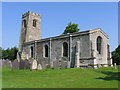
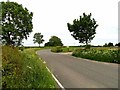
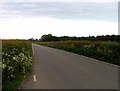
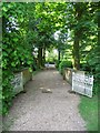
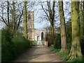
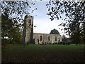
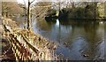
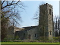
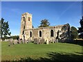
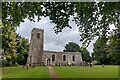
40 photos from this area
Area Information
Key information about the LE8 0QF including its size, population, and administrative classification.
- Area Type
- Postcode
- Area Size
- 2.7 km²
- Population
- 1721
- Population Density
- 142 people/km²
House Prices in LE8 0QF
33
Properties
-
Average Sold Price
-
Lowest Price
-
Highest Price
Showing 33 properties
| Address | Type | Beds | Baths | Last Sale Price | Last Sale Date | |
|---|---|---|---|---|---|---|
| M J Ward Garage Workshop, Wistow Rural Centre, Kibworth Road, Wistow, LE8 0QF | Industrial | - | - | - | - | |
| Wistow Farm Estate Office, Kibworth Road, Wistow, LE8 0QF | Office | - | - | - | - | |
| Mediterranean Deli And Farm Shop, Wistow Rural Centre, Kibworth Road, Wistow, LE8 0QF | shop | - | - | - | - | |
| Hairdressing Salon, Wistow Home Farm, Kibworth Road, Wistow, LE8 0QF | Retail | - | - | - | - | |
| Denbigh, Wistow Hall, Kibworth Road, Wistow, LE8 0QF | Flat | - | - | - | - | |
| Wistow Rural Centre, Kibworth Road, Wistow, LE8 0QF | shop | - | - | - | - | |
| Browns, Wistow Hall, Kibworth Road, Wistow, LE8 0QF | Maisonette | - | - | - | - | |
| Wistow Grange, Kibworth Road, Wistow, LE8 0QF | Terraced | - | - | - | - | |
| Wistow Grange Cottage, Kibworth Road, Wistow, LE8 0QF | Detached | - | - | - | - | |
| Mount Cottage, Wistow Grange, Kibworth Road, Wistow, LE8 0QF | Detached | - | - | - | - |
Page 1 of 4
Energy Efficiency in LE8 0QF
Amenities
Schools
| Rank | School | Type | Entry gender | Ages |
|---|
Explore more schools in this area
Go to Schools tabDemographics
Household Size
Family (3-5 people)
most common
Accommodation Type
Houses
most common
Tenure
77
majority
Ethnic Group
White
most common
Religion
N/A
most common
Household Composition
N/A
most common
Age
47
median
Adults (30-64 years)
most common
Household Deprivation
N/A
with no deprivation
NS-SEC
48
in Lower managerial occupations
Explore more demographic insights in this area
Go to Demographics tabPlanning
Planning Constraints
- Flood RiskPremium
- Ramsar Wetland SitesPremium
- Area of Outstanding Natural BeautyPremium
- Protected Nature ReservePremium
- Protected WoodlandPremium