Area Overview for LE8 0NG
Photos of LE8 0NG
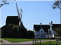
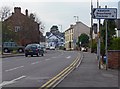
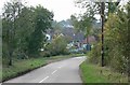
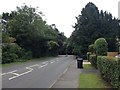
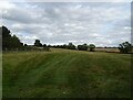
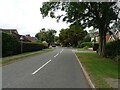
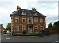
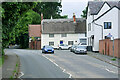
45 photos from this area
Area Information
Key information about the LE8 0NG including its size, population, and administrative classification.
- Area Type
- Postcode
- Area Size
- 1.7 hectares
- Population
- 2286
- Population Density
- 3606 people/km²
House Prices in LE8 0NG
30
Properties
£173,568
Average Sold Price
£57,950
Lowest Price
£285,000
Highest Price
Showing 30 properties
| Address | Type | Beds | Baths | Last Sale Price | Last Sale Date | |
|---|---|---|---|---|---|---|
| 35 Hillcrest Avenue, Kibworth Beauchamp, LE8 0NG | Semi-detached | 3 | 1 | £250,000 | Apr 2025 | |
| 15 Hillcrest Avenue, Kibworth Beauchamp, LE8 0NG | house | - | - | £285,000 | Feb 2022 | |
| 13 Hillcrest Avenue, Kibworth Beauchamp, LE8 0NG | house | - | - | £250,000 | Mar 2019 | |
| 7 Hillcrest Avenue, Kibworth Beauchamp, LE8 0NG | house | 3 | - | £200,000 | Jul 2017 | |
| 9 Hillcrest Avenue, Kibworth Beauchamp, LE8 0NG | house | - | - | £200,000 | Jul 2015 | |
| 31 Hillcrest Avenue, Kibworth Beauchamp, LE8 0NG | Semi-detached | 3 | - | £138,000 | May 2015 | |
| 1 Hillcrest Avenue, Kibworth Beauchamp, LE8 0NG | Semi-detached | 3 | 1 | £170,000 | Jul 2014 | |
| 25 Hillcrest Avenue, Kibworth Beauchamp, LE8 0NG | Semi-detached | - | - | £135,000 | Feb 2012 | |
| 43 Hillcrest Avenue, Kibworth Beauchamp, LE8 0NG | house | 3 | 1 | £134,000 | Jul 2011 | |
| 45 Hillcrest Avenue, Kibworth Beauchamp, LE8 0NG | Semi-detached | - | - | £120,000 | Oct 2008 |
Page 1 of 3
Energy Efficiency in LE8 0NG
Amenities
Schools
| Rank | School | Type | Entry gender | Ages |
|---|
Explore more schools in this area
Go to Schools tabDemographics
Household Size
Family (3-5 people)
most common
Accommodation Type
Houses
most common
Tenure
65
majority
Ethnic Group
White
most common
Religion
N/A
most common
Household Composition
N/A
most common
Age
47
median
Adults (30-64 years)
most common
Household Deprivation
N/A
with no deprivation
NS-SEC
43
in Lower managerial occupations
Explore more demographic insights in this area
Go to Demographics tabPlanning
Planning Constraints
- Flood RiskPremium
- Ramsar Wetland SitesPremium
- Area of Outstanding Natural BeautyPremium
- Protected Nature ReservePremium
- Protected WoodlandPremium