Area Overview for LE8 0EY
Photos of LE8 0EY
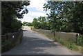
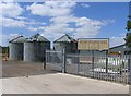
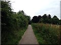
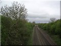
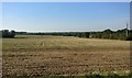
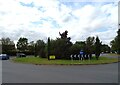
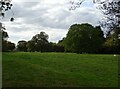
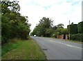
18 photos from this area
Area Information
Key information about the LE8 0EY including its size, population, and administrative classification.
- Area Type
- Postcode
- Area Size
- 2.2 hectares
- Population
- 2286
- Population Density
- 3606 people/km²
House Prices in LE8 0EY
17
Properties
£230,765
Average Sold Price
£125,000
Lowest Price
£320,000
Highest Price
Showing 17 properties
| Address | Type | Beds | Baths | Last Sale Price | Last Sale Date | |
|---|---|---|---|---|---|---|
| 193 Dairy Way, Kibworth Harcourt, LE8 0EY | Detached | 3 | 1 | £320,000 | Jan 2023 | |
| 203 Dairy Way, Kibworth Harcourt, LE8 0EY | Detached | 3 | 2 | £280,000 | Aug 2022 | |
| 211 Dairy Way, Kibworth Harcourt, LE8 0EY | house | - | - | £252,000 | Mar 2022 | |
| 201 Dairy Way, Kibworth Harcourt, LE8 0EY | Semi-detached | 3 | 1 | £292,500 | Oct 2021 | |
| 217 Dairy Way, Kibworth Harcourt, LE8 0EY | house | - | - | £260,000 | Oct 2021 | |
| 219 Dairy Way, Kibworth Harcourt, LE8 0EY | house | - | - | £225,000 | Apr 2019 | |
| 213 Dairy Way, Kibworth Harcourt, LE8 0EY | Semi-detached | 3 | 2 | £189,995 | May 2015 | |
| 215 Dairy Way, Kibworth Harcourt, LE8 0EY | house | - | - | £191,995 | Mar 2015 | |
| 209 Dairy Way, Kibworth Harcourt, LE8 0EY | house | - | - | £175,000 | Mar 2015 | |
| 205 Dairy Way, Kibworth Harcourt, LE8 0EY | house | - | - | £174,995 | Dec 2014 |
Page 1 of 2
Energy Efficiency in LE8 0EY
Amenities
Schools
| Rank | School | Type | Entry gender | Ages |
|---|
Explore more schools in this area
Go to Schools tabDemographics
Household Size
Family (3-5 people)
most common
Accommodation Type
Houses
most common
Tenure
65
majority
Ethnic Group
White
most common
Religion
N/A
most common
Household Composition
N/A
most common
Age
47
median
Adults (30-64 years)
most common
Household Deprivation
N/A
with no deprivation
NS-SEC
43
in Lower managerial occupations
Explore more demographic insights in this area
Go to Demographics tabPlanning
Planning Constraints
- Flood RiskPremium
- Ramsar Wetland SitesPremium
- Area of Outstanding Natural BeautyPremium
- Protected Nature ReservePremium
- Protected WoodlandPremium