Area Overview for LE7 9WP
Photos of LE7 9WP
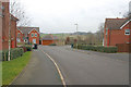
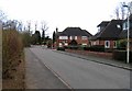
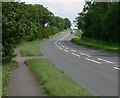
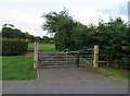
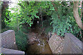
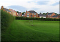
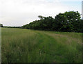
28 photos from this area
Area Information
Key information about the LE7 9WP including its size, population, and administrative classification.
- Area Type
- Postcode
- Area Size
- 4802 m²
- Population
- 1534
- Population Density
- 1866 people/km²
House Prices in LE7 9WP
19
Properties
£319,043
Average Sold Price
£185,148
Lowest Price
£464,950
Highest Price
Showing 19 properties
| Address | Type | Beds | Baths | Last Sale Price | Last Sale Date | |
|---|---|---|---|---|---|---|
| 1 Perry Grove, Scraptoft, LE7 9WP | house | - | - | £464,950 | Jun 2022 | |
| 5 Perry Grove, Scraptoft, LE7 9WP | house | - | - | £400,320 | Mar 2022 | |
| 19 Perry Grove, Scraptoft, LE7 9WP | house | - | - | £314,950 | Jan 2022 | |
| 16 Perry Grove, Scraptoft, LE7 9WP | house | - | - | £185,148 | Dec 2021 | |
| 8 Perry Grove, Scraptoft, LE7 9WP | house | - | - | £407,826 | Nov 2021 | |
| 4 Perry Grove, Scraptoft, LE7 9WP | house | - | - | £200,160 | Oct 2021 | |
| 2 Perry Grove, Scraptoft, LE7 9WP | house | - | - | £259,950 | Sep 2021 | |
| 18 Perry Grove, Scraptoft, LE7 9WP | house | - | - | - | - | |
| 13 Perry Grove, Scraptoft, LE7 9WP | house | - | - | - | - | |
| 6 Perry Grove, Scraptoft, LE7 9WP | house | - | - | - | - |
Page 1 of 2
Energy Efficiency in LE7 9WP
Amenities
Schools
| Rank | School | Type | Entry gender | Ages |
|---|
Explore more schools in this area
Go to Schools tabDemographics
Household Size
Family (3-5 people)
most common
Accommodation Type
Houses
most common
Tenure
91
majority
Ethnic Group
White
most common
Religion
N/A
most common
Household Composition
N/A
most common
Age
47
median
Adults (30-64 years)
most common
Household Deprivation
N/A
with no deprivation
NS-SEC
36
in Lower managerial occupations
Explore more demographic insights in this area
Go to Demographics tabPlanning
Planning Constraints
- Flood RiskPremium
- Ramsar Wetland SitesPremium
- Area of Outstanding Natural BeautyPremium
- Protected Nature ReservePremium
- Protected WoodlandPremium