Area Overview for LE7 9WD
Photos of LE7 9WD
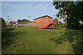
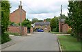
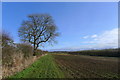
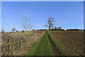
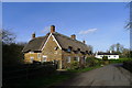
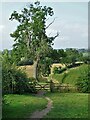
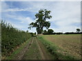
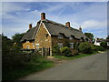
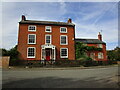
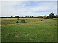
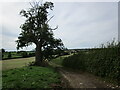
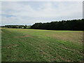
25 photos from this area
Area Information
Key information about the LE7 9WD including its size, population, and administrative classification.
- Area Type
- Postcode
- Area Size
- 85.7 hectares
- Population
- 2197
- Population Density
- 23 people/km²
House Prices in LE7 9WD
48
Properties
£436,375
Average Sold Price
£135,000
Lowest Price
£1,600,000
Highest Price
Showing 48 properties
| Address | Type | Beds | Baths | Last Sale Price | Last Sale Date | |
|---|---|---|---|---|---|---|
| Meadow View, Main Street, Tugby, LE7 9WD | Semi-detached | 3 | 1 | £195,750 | Jan 2025 | |
| Barncroft, Main Street, Tugby, LE7 9WD | Detached | 4 | 2 | £725,000 | Apr 2024 | |
| Rosedene Cottage, Main Street, Tugby, LE7 9WD | house | - | - | £1,600,000 | Aug 2023 | |
| Wishing Well Cottage, Main Street, Tugby, LE7 9WD | house | - | - | £695,000 | Jun 2023 | |
| Black Horse Cottage, Main Street, Tugby, LE7 9WD | Detached | 4 | 3 | £692,011 | Jun 2022 | |
| Hawthorn Cottage, Main Street, Tugby, LE7 9WD | house | - | - | £290,000 | Jun 2022 | |
| 1, Clematis Cottage, Main Street, Tugby, LE7 9WD | house | - | - | £156,000 | Dec 2021 | |
| Orchard House, Main Street, Tugby, LE7 9WD | Detached | 4 | 2 | £675,000 | Apr 2021 | |
| The Old Vicarage, Main Street, Tugby, LE7 9WD | house | - | - | £605,000 | Jan 2020 | |
| Little Shutters, Main Street, Tugby, LE7 9WD | Detached | 4 | 3 | £535,000 | Oct 2019 |
Page 1 of 5
Energy Efficiency in LE7 9WD
Amenities
Schools
| Rank | School | Type | Entry gender | Ages |
|---|
Explore more schools in this area
Go to Schools tabDemographics
Household Size
Two person
most common
Accommodation Type
Houses
most common
Tenure
81
majority
Ethnic Group
White
most common
Religion
N/A
most common
Household Composition
N/A
most common
Age
47
median
Adults (30-64 years)
most common
Household Deprivation
N/A
with no deprivation
NS-SEC
43
in Lower managerial occupations
Explore more demographic insights in this area
Go to Demographics tabPlanning
Planning Constraints
- Flood RiskPremium
- Ramsar Wetland SitesPremium
- Area of Outstanding Natural BeautyPremium
- Protected Nature ReservePremium
- Protected WoodlandPremium