Area Overview for LE7 9QR
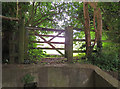
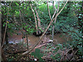
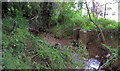
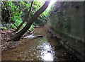
Photos of LE7 9QR


Area Information
Living in LE7 9QR offers a quiet, residential experience within a compact postcode area. With a population of 2,095 and a density of 767 people per square kilometre, this small cluster of homes balances space with community. The area is characterised by a mature demographic, with a median age of 47 and a majority of residents aged 30–64. Most properties are owner-occupied, reflecting a stable, long-term presence. Daily life here is shaped by proximity to essential services, including multiple Co-op stores in nearby Thurnby and Scraptoft, and easy access to Leicester Airport. The area’s low crime risk score of 74 and absence of environmental constraints like protected woodlands or AONB designations make it a practical choice for families and professionals. With excellent broadband connectivity rated 98 out of 100, residents can work remotely or stay connected effortlessly. The mix of rail and metro links, including Leicester Railway Station and Great Central Railway, ensures reliable transport options for commuting or leisure. LE7 9QR is a small but functional postcode, ideal for those seeking a settled, low-maintenance lifestyle near urban amenities.
- Area Type
- Postcode
- Area Size
- Not available
- Population
- 2095
- Population Density
- 767 people/km²
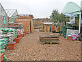
The property market in LE7 9QR is dominated by owner-occupied homes, with 91% of properties in private hands. This high rate of home ownership suggests a stable, long-term resident base with little reliance on rental markets. The accommodation type is exclusively houses, which contrasts with areas where flats or apartments predominate. This makes LE7 9QR particularly suited to families or individuals seeking more space and privacy. The small postcode area means the housing stock is limited, so buyers should consider nearby regions for broader options. The absence of planning constraints like protected woodlands or AONB designations allows for greater flexibility in property use or renovations. However, the compact size of the area may limit the variety of properties available. For buyers, this translates to a market where established homes are in demand, but new developments are unlikely. The focus on owner-occupation also means rental properties are scarce, which could be a consideration for those needing short-term housing.
House Prices in LE7 9QR
No properties found in this postcode.
Energy Efficiency in LE7 9QR
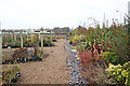
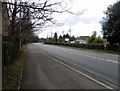
Residents of LE7 9QR have access to a range of amenities within practical reach. Retail options include five local Co-ops, such as Co-op Thurnby and Co-op Scraptoft, providing everyday shopping convenience. The nearby Leicester Airport offers travel flexibility, while rail stations like Leicester Railway Station and Syston Railway Station connect to broader networks. Metro services, including Leicester North and Great Central Railway, add to the area’s transport diversity. While the data does not specify parks or leisure facilities, the absence of protected natural sites suggests open spaces may be limited. The retail and transport infrastructure ensures daily life is efficient, with minimal need to travel far for essentials. The area’s compact size means amenities are closely clustered, fostering a sense of accessibility. For those prioritising convenience over expansive leisure options, LE7 9QR’s lifestyle offers a balance of practicality and proximity to urban services.
Amenities
Schools
| Rank | School | Type | Entry gender | Ages |
|---|
Explore more schools in this area
Go to Schools tabDemographics
The community in LE7 9QR is predominantly composed of adults aged 30–64, with a median age of 47. This suggests a mature population, likely with established careers and family ties. Home ownership is exceptionally high at 91%, indicating a strong preference for long-term residency over rental properties. The accommodation type is almost exclusively houses, which aligns with the area’s residential character and may appeal to those seeking more space than flats. The predominant ethnic group is White, though the data does not specify further diversity metrics. The population density of 767 people per square kilometre suggests a compact, closely knit community. While no specific deprivation data is provided, the high home ownership rate and low crime risk imply a relatively stable quality of life. The absence of protected natural sites or planning constraints also means residents face fewer restrictions on property modifications or development. This demographic profile paints a picture of a settled, family-oriented area with minimal turnover.
Household Size
Accommodation Type
Tenure
Ethnic Group
Religion
Household Composition
Age
Household Deprivation
NS-SEC
Explore more demographic insights in this area
Go to Demographics tabPlanning
Planning Constraints
- Flood RiskPremium
- Ramsar Wetland SitesPremium
- Area of Outstanding Natural BeautyPremium
- Protected Nature ReservePremium
- Protected WoodlandPremium