Area Overview for LE7 9PB
Photos of LE7 9PB
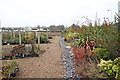
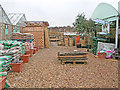
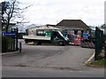

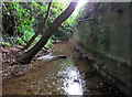
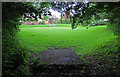
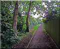
45 photos from this area
Area Information
Key information about the LE7 9PB including its size, population, and administrative classification.
- Area Type
- Postcode
- Area Size
- 2.2 hectares
- Population
- 1747
- Population Density
- 234 people/km²
House Prices in LE7 9PB
37
Properties
£224,392
Average Sold Price
£51,000
Lowest Price
£592,800
Highest Price
Showing 37 properties
| Address | Type | Beds | Baths | Last Sale Price | Last Sale Date | |
|---|---|---|---|---|---|---|
| 50 Charnwood Drive, Thurnby, LE7 9PB | Semi-detached | 3 | 1 | £337,000 | Dec 2025 | |
| 66 Charnwood Drive, Thurnby, LE7 9PB | Semi-detached | 2 | 1 | £300,000 | Jul 2023 | |
| 42 Charnwood Drive, Thurnby, LE7 9PB | house | - | - | £312,500 | Nov 2021 | |
| 12 Charnwood Drive, Thurnby, LE7 9PB | house | - | - | £592,800 | Sep 2021 | |
| 74 Charnwood Drive, Thurnby, LE7 9PB | Bungalow | - | - | £405,000 | Mar 2021 | |
| 70 Charnwood Drive, Thurnby, LE7 9PB | Bungalow | - | - | £250,000 | Jan 2021 | |
| 62 Charnwood Drive, Thurnby, LE7 9PB | Bungalow | - | - | £280,000 | Sep 2020 | |
| 46 Charnwood Drive, Thurnby, LE7 9PB | house | - | - | £160,000 | Jul 2020 | |
| 34 Charnwood Drive, Thurnby, LE7 9PB | Semi-detached | 4 | 1 | £285,000 | Jun 2019 | |
| 24 Charnwood Drive, Thurnby, LE7 9PB | Detached | 6 | 3 | £317,500 | Feb 2018 |
Page 1 of 4
Energy Efficiency in LE7 9PB
Amenities
Schools
| Rank | School | Type | Entry gender | Ages |
|---|
Explore more schools in this area
Go to Schools tabDemographics
Household Size
Two person
most common
Accommodation Type
Houses
most common
Tenure
81
majority
Ethnic Group
White
most common
Religion
N/A
most common
Household Composition
N/A
most common
Age
47
median
Adults (30-64 years)
most common
Household Deprivation
N/A
with no deprivation
NS-SEC
38
in Lower managerial occupations
Explore more demographic insights in this area
Go to Demographics tabPlanning
Planning Constraints
- Flood RiskPremium
- Ramsar Wetland SitesPremium
- Area of Outstanding Natural BeautyPremium
- Protected Nature ReservePremium
- Protected WoodlandPremium