Area Overview for LE7 9LD
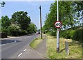
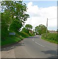
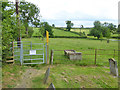
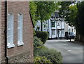
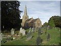
Photos of LE7 9LD


Area Information
Living in LE7 9LD offers a quiet, low-density lifestyle in a small residential cluster in England. With a population of 2197 spread across 23 people per square kilometre, the area feels unspoiled by urban sprawl. The community is predominantly composed of adults aged 30–64, with a median age of 47, suggesting a stable, mature demographic. Most homes are owner-occupied, and the area is largely free from environmental constraints such as protected woodlands or wetlands. Daily life here is defined by proximity to essential services: nearby Co-ops in Houghton, Thurnby, and Scraptoft provide retail convenience, while Leicester Railway Station and Syston Station offer rail access to nearby cities. The low crime risk score of 80 and minimal flood risk make it a safe, practical choice for those seeking a balanced blend of tranquillity and connectivity. For buyers, LE7 9LD represents a compact, family-friendly environment where the pace of life is measured, and community ties are likely to be strong.
- Area Type
- Postcode
- Area Size
- Not available
- Population
- 2197
- Population Density
- 23 people/km²
The property market in LE7 9LD is characterised by high home ownership (81%) and a focus on houses rather than flats or apartments. This suggests a traditional, family-oriented housing stock with limited rental activity. The low population density and small cluster of homes indicate that the area is not a high-demand commuter zone but rather a place where residents prioritise space and privacy. Buyers should expect a limited selection of properties, given the area’s size, but the emphasis on owner-occupation may foster a sense of community and long-term stability. The absence of large-scale development or planning constraints means the housing stock is likely to retain its character. For those seeking a home, LE7 9LD offers a niche market where properties are likely to be well-maintained and suited to those valuing a slower pace of life.
House Prices in LE7 9LD
No properties found in this postcode.
Energy Efficiency in LE7 9LD
The lifestyle in LE7 9LD is shaped by its proximity to essential amenities and a small-scale, community-oriented environment. Local retail options include Co-ops in Houghton, Thurnby, and Scraptoft, offering everyday shopping needs within practical reach. The area’s rail links to Leicester and Syston provide access to broader services, while Leicester Airport caters to regional travel. Though the area lacks large leisure facilities, the low population density and absence of environmental constraints suggest open spaces for walking or cycling. The presence of multiple primary schools and a low crime risk score indicate a family-friendly atmosphere, where daily life revolves around local shops, schools, and transport links. Residents benefit from a straightforward, uncluttered lifestyle, with amenities designed to meet basic needs without the complexity of a larger urban setting.
Amenities
Schools
Residents of LE7 9LD have access to three primary schools: Tilton Church of England Primary School and two instances of Tugby Church of England Primary School, one of which holds an Ofsted rating of ‘good’. These schools cater to younger children, with the Tugby school’s positive rating indicating a potentially high standard of education. The presence of multiple primary schools within reach suggests that families have options for their children’s early education, though no secondary schools are listed. The availability of two primary schools in the same area may reduce competition for places but also means parents must consider proximity to their preferred school. The lack of secondary school data means families may need to look further afield for comprehensive education, though the existing primary options provide a solid foundation for early learning.
| Rank | School | Type | Entry gender | Ages |
|---|
Explore more schools in this area
Go to Schools tabDemographics
The population of LE7 9LD is 2197, with a median age of 47, reflecting a community skewed toward middle-aged adults. The most common age range is 30–64 years, indicating a stable, established population with fewer young families or retirees. Home ownership is high, at 81%, suggesting a long-term commitment to the area. The predominant accommodation type is houses, which aligns with the low population density and the character of a small residential cluster. The ethnic composition is predominantly White, though no specific data on diversity or deprivation is provided. This demographic profile suggests a neighbourhood where most residents are settled in their homes, with limited turnover. The absence of specific data on deprivation means the quality of life cannot be fully assessed, but the high home ownership and low crime risk imply a relatively secure, stable environment for residents.
Household Size
Accommodation Type
Tenure
Ethnic Group
Religion
Household Composition
Age
Household Deprivation
NS-SEC
Explore more demographic insights in this area
Go to Demographics tabPlanning
Planning Constraints
- Flood RiskPremium
- Ramsar Wetland SitesPremium
- Area of Outstanding Natural BeautyPremium
- Protected Nature ReservePremium
- Protected WoodlandPremium