Area Overview for LE7 9JR
Photos of LE7 9JR
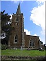
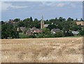
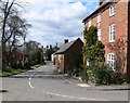
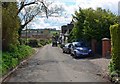
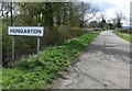
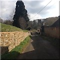
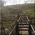
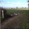

51 photos from this area
Area Information
Key information about the LE7 9JR including its size, population, and administrative classification.
- Area Type
- Postcode
- Area Size
- 33.0 hectares
- Population
- 2197
- Population Density
- 23 people/km²
House Prices in LE7 9JR
36
Properties
£482,875
Average Sold Price
£130,000
Lowest Price
£1,125,000
Highest Price
Showing 36 properties
| Address | Type | Beds | Baths | Last Sale Price | Last Sale Date | |
|---|---|---|---|---|---|---|
| Church Paddock, Main Street, Hungarton, LE7 9JR | house | - | - | £1,125,000 | Mar 2025 | |
| Peartree Cottage, Main Street, Hungarton, LE7 9JR | house | - | - | £385,000 | Feb 2024 | |
| Jasmine Cottage, Main Street, Hungarton, LE7 9JR | house | - | - | £450,000 | Jul 2022 | |
| The Close, Main Street, Hungarton, LE7 9JR | Detached | 3 | 1 | £445,123 | Jun 2022 | |
| The Grange, Main Street, Hungarton, LE7 9JR | house | - | - | £730,000 | Oct 2019 | |
| The Beeches, Main Street, Hungarton, LE7 9JR | Detached | 4 | 3 | £610,000 | Jun 2019 | |
| The Old Post House, Main Street, Hungarton, LE7 9JR | Terraced | - | - | £410,000 | Feb 2018 | |
| The Cottage, Main Street, Hungarton, LE7 9JR | house | - | - | £615,000 | Jan 2017 | |
| The Manor House, Main Street, Hungarton, LE7 9JR | Detached | 5 | 3 | £770,000 | Dec 2016 | |
| The Old Forge, Main Street, Hungarton, LE7 9JR | Detached | 3 | 2 | £370,000 | Sep 2014 |
Page 1 of 4
Energy Efficiency in LE7 9JR
Amenities
Schools
| Rank | School | Type | Entry gender | Ages |
|---|
Explore more schools in this area
Go to Schools tabDemographics
Household Size
Two person
most common
Accommodation Type
Houses
most common
Tenure
81
majority
Ethnic Group
White
most common
Religion
N/A
most common
Household Composition
N/A
most common
Age
47
median
Adults (30-64 years)
most common
Household Deprivation
N/A
with no deprivation
NS-SEC
43
in Lower managerial occupations
Explore more demographic insights in this area
Go to Demographics tabPlanning
Planning Constraints
- Flood RiskPremium
- Ramsar Wetland SitesPremium
- Area of Outstanding Natural BeautyPremium
- Protected Nature ReservePremium
- Protected WoodlandPremium