Area Overview for LE7 8JB
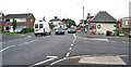
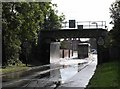
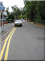
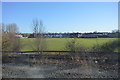
Photos of LE7 8JB


Area Information
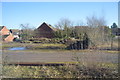
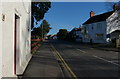
Living in LE7 8JB offers a quiet, residential experience in a small cluster of homes, home to around 1,651 people. The area is defined by its compact nature, with a population that skews towards adults aged 30–64, reflecting a mature, settled community. Daily life here is shaped by proximity to essential services and transport links. The presence of multiple railway stations, including Syston and Sileby, ensures easy access to nearby towns and cities. Retail options are practical, with stores like Tesco Syston and Aldi Syston within reach. While the area lacks large-scale amenities, its small size fosters a close-knit feel. The housing stock is predominantly owner-occupied, with a focus on houses rather than flats, suggesting a stable, long-term demographic. For those seeking a low-maintenance lifestyle with reliable connectivity and a manageable population, LE7 8JB provides a straightforward, unpretentious base.
- Area Type
- Postcode
- Area Size
- Not available
- Population
- 1651
- Population Density
- 4977 people/km²
The property market in LE7 8JB is characterised by a 60% home ownership rate, with houses making up the majority of the housing stock. This indicates a community where long-term residency is common, and the area is less likely to be dominated by rental properties. The focus on owner-occupied homes suggests a stable market, though the small size of the postcode means the housing stock is limited. Buyers should consider the immediate surrounding areas for more options, as the cluster of homes within LE7 8JB itself is modest in scale. The presence of houses rather than flats may appeal to those seeking space and privacy. However, the market’s compact nature means competition for properties could be higher, particularly for those prioritising specific locations within the cluster.
House Prices in LE7 8JB
No properties found in this postcode.
Energy Efficiency in LE7 8JB
The lifestyle in LE7 8JB is shaped by its proximity to practical amenities, including five retail outlets such as Tesco Syston and Aldi Syston, which cater to everyday needs. The area’s railway stations—Syston, Sileby, and Barrow upon Soar—offer connections to nearby towns, while metro lines like Great Central Railway and Leicester North provide additional mobility. Though the area lacks large parks or entertainment hubs, the presence of multiple retail and transport options ensures convenience for daily life. The compact nature of the community means residents can access shops, dining, and transport without long commutes. This balance of practicality and accessibility makes LE7 8JB a viable choice for those prioritising functionality over expansive leisure facilities.
Amenities
Schools
| Rank | School | Type | Entry gender | Ages |
|---|
Explore more schools in this area
Go to Schools tabDemographics
The community in LE7 8JB is composed largely of adults aged 30–64, with a median age of 47. This suggests a population that is largely established, with fewer young families or retirees compared to other areas. Home ownership stands at 60%, indicating a mix of long-term residents and those who have chosen to buy in the area. The accommodation type is primarily houses, which aligns with the demographic profile of older, settled households. The predominant ethnic group is White, with no specific data provided on other ethnicities. While the area’s small size means diversity statistics are limited, the absence of notable deprivation indicators implies a generally stable economic profile. The age distribution and housing type suggest a community focused on comfort and continuity, with little turnover in property ownership.
Household Size
Accommodation Type
Tenure
Ethnic Group
Religion
Household Composition
Age
Household Deprivation
NS-SEC
Explore more demographic insights in this area
Go to Demographics tabPlanning
Planning Constraints
- Flood RiskPremium
- Ramsar Wetland SitesPremium
- Area of Outstanding Natural BeautyPremium
- Protected Nature ReservePremium
- Protected WoodlandPremium