Area Overview for LE7 7WR
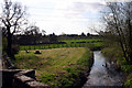
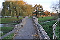
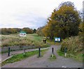
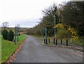
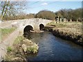
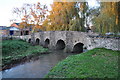
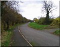
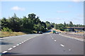
Photos of LE7 7WR
Area Information
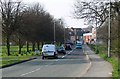
Living in LE7 7WR offers a compact, residential experience shaped by its small cluster of homes and a population of 1,730 people. With a population density of 1,155 people per square kilometre, this area balances proximity with a sense of community. The median age of 47 suggests a mature demographic, with adults aged 30–64 forming the largest group. This reflects a neighbourhood where many residents are likely established in their careers or retired, contributing to a stable local environment. The area’s housing stock is predominantly houses, with 67% of properties owner-occupied, indicating a mix of long-term residents and those seeking a settled lifestyle. Nearby, The Latimer Primary School, rated outstanding by Ofsted, ensures families have access to high-quality education. The area’s proximity to retail outlets, rail networks, and historical transport routes like the Great Central Railway adds practicality to daily life. While small, LE7 7WR offers a blend of convenience and quiet living, appealing to those who value accessibility without urban chaos.
- Area Type
- Postcode
- Area Size
- Not available
- Population
- 1730
- Population Density
- 1155 people/km²
The property market in LE7 7WR is characterised by a strong presence of owner-occupied homes, with 67% of properties owned by residents. This contrasts with rental markets that dominate in more transient areas, suggesting a community of long-term residents. The predominant accommodation type—houses—indicates a focus on family-friendly or spacious living, though the area’s small size means the housing stock is limited. Buyers should consider the compact nature of LE7 7WR, as the immediate surroundings may offer more options. The high home ownership rate also implies a steady demand for properties, potentially supporting long-term value retention. However, the area’s small scale means competition for available homes could be keen, particularly for those prioritising specific features like proximity to schools or transport links.
House Prices in LE7 7WR
No properties found in this postcode.
Energy Efficiency in LE7 7WR
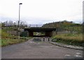
Daily life in LE7 7WR is enriched by nearby amenities that cater to practical needs. The five retail outlets, including Co-op Anstey and Aldi, provide essential shopping options, while the presence of four rail and four metro stations ensures easy access to broader networks. These transport links connect residents to Leicester’s urban centres, historical sites like Rothley, and commuter routes. Though the area itself is small, its proximity to the Great Central Railway and Leicester Railway Station enhances mobility. The mix of retail and transport infrastructure supports a lifestyle that prioritises convenience without sacrificing the area’s residential charm. This blend of accessibility and local character makes LE7 7WR suitable for those who value ease of movement and proximity to services without the density of a larger city.
Amenities
Schools
The Latimer Primary School is the only school explicitly listed near LE7 7WR, serving the area’s primary education needs. Rated outstanding by Ofsted, it provides a high standard of teaching and facilities for local children. As a primary school, it caters to younger families, though no secondary schools are mentioned in the data. This means families may need to look beyond the immediate area for secondary education options. The presence of a top-rated primary school is a significant draw for households with children, offering reassurance about educational quality. However, the absence of additional schools highlights the importance of proximity to other educational institutions when considering the area’s suitability for growing families.
| Rank | School | Type | Entry gender | Ages |
|---|---|---|---|---|
| 1 | The Latimer Primary School | primary | N/A | N/A |
Explore more schools in this area
Go to Schools tabDemographics
The community in LE7 7WR is defined by its median age of 47, with adults aged 30–64 making up the majority. This suggests a population largely in their prime working years or nearing retirement, contributing to a stable and experienced local demographic. Home ownership stands at 67%, reflecting a preference for long-term residency over rental properties. The predominant accommodation type is houses, aligning with the area’s residential character. The predominant ethnic group is White, though no data is provided on other groups. The absence of specific deprivation metrics means the quality of life cannot be assessed in terms of socioeconomic challenges, but the low crime risk score of 71 (a below-average rate) indicates a generally safe environment. This profile suggests a community focused on stability, with families and professionals coexisting in a setting that prioritises security and established living.
Household Size
Accommodation Type
Tenure
Ethnic Group
Religion
Household Composition
Age
Household Deprivation
NS-SEC
Explore more demographic insights in this area
Go to Demographics tabPlanning
Planning Constraints
- Flood RiskPremium
- Ramsar Wetland SitesPremium
- Area of Outstanding Natural BeautyPremium
- Protected Nature ReservePremium
- Protected WoodlandPremium
- Crime RiskPremium