Area Overview for LE7 7NF
Photos of LE7 7NF
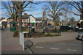
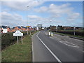
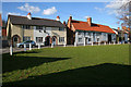
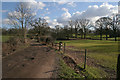
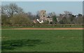
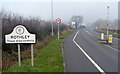
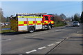
58 photos from this area
Area Information
Key information about the LE7 7NF including its size, population, and administrative classification.
- Area Type
- Postcode
- Area Size
- 4.1 hectares
- Population
- 2338
- Population Density
- 928 people/km²
House Prices in LE7 7NF
23
Properties
£252,073
Average Sold Price
£89,000
Lowest Price
£475,000
Highest Price
Showing 23 properties
| Address | Type | Beds | Baths | Last Sale Price | Last Sale Date | |
|---|---|---|---|---|---|---|
| 37 Hallfields Lane, Rothley, LE7 7NF | house | - | - | £475,000 | Jun 2021 | |
| 41 Hallfields Lane, Rothley, LE7 7NF | house | - | - | £315,000 | May 2021 | |
| 51 Hallfields Lane, Rothley, LE7 7NF | house | - | - | £324,000 | Mar 2021 | |
| 23 Hallfields Lane, Rothley, LE7 7NF | house | - | - | £185,000 | Oct 2017 | |
| 29 Hallfields Lane, Rothley, LE7 7NF | Semi-detached | 4 | 2 | £290,000 | Jun 2016 | |
| 6 Hallfields Lane, Rothley, LE7 7NF | Bungalow | 3 | 1 | £430,000 | Jan 2014 | |
| 39 Hallfields Lane, Rothley, LE7 7NF | house | - | - | £159,950 | Jul 2010 | |
| 43 Hallfields Lane, Rothley, LE7 7NF | house | - | - | £231,000 | Dec 2009 | |
| 27 Hallfields Lane, Rothley, LE7 7NF | Terraced | - | - | £247,000 | Sep 2007 | |
| 49 Hallfields Lane, Rothley, LE7 7NF | Detached | - | - | £224,000 | May 2004 |
Page 1 of 3
Energy Efficiency in LE7 7NF
Amenities
Schools
| Rank | School | Type | Entry gender | Ages |
|---|
Explore more schools in this area
Go to Schools tabDemographics
Household Size
Two person
most common
Accommodation Type
Houses
most common
Tenure
78
majority
Ethnic Group
White
most common
Religion
N/A
most common
Household Composition
N/A
most common
Age
47
median
Adults (30-64 years)
most common
Household Deprivation
N/A
with no deprivation
NS-SEC
47
in Lower managerial occupations
Explore more demographic insights in this area
Go to Demographics tabPlanning
Planning Constraints
- Flood RiskPremium
- Ramsar Wetland SitesPremium
- Area of Outstanding Natural BeautyPremium
- Protected Nature ReservePremium
- Protected WoodlandPremium