Area Overview for LE7 7LG
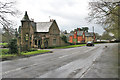
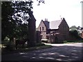
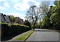
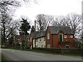
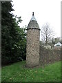
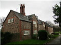
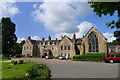
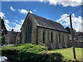
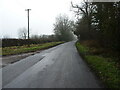
Photos of LE7 7LG

Area Information
Living in LE7 7LG offers a compact, residential experience shaped by its small footprint of 7.8 hectares and a population of 2,338. This postcode area is a tight-knit cluster, with a population density of 928 people per square kilometre, suggesting a mix of established homes and community spaces. The area is defined by its proximity to key transport links and local amenities, making it practical for daily life. Residents benefit from nearby railway stations, including Sileby and Barrow upon Soar, which connect to Leicester and beyond. The presence of multiple retail outlets, such as Co-op Rothley and Waitrose Little, ensures convenience for shopping and dining. While the area lacks expansive green spaces, its focus on accessibility and essential services caters to those prioritising practicality over rural scenery. LE7 7LG is ideal for individuals or families seeking a balanced lifestyle, with a strong emphasis on connectivity and local infrastructure. Its compact size means neighbours are close, fostering a sense of familiarity, though the community remains modest in scale.
- Area Type
- Postcode
- Area Size
- 7.8 hectares
- Population
- 2338
- Population Density
- 928 people/km²
The property market in LE7 7LG is characterised by a strong emphasis on owner-occupation, with 78% of homes owned by residents. This suggests a stable, long-term demographic rather than a transient rental market. The predominant accommodation type is houses, which aligns with the area’s small size and residential focus. Given the compact nature of LE7 7LG, properties are likely to be family homes or single-occupancy residences, with limited scope for larger developments. Buyers in this area may find a mix of traditional housing styles, though the lack of flats or apartments means the market is not suited to those seeking high-density living. The high home ownership rate also implies competitive demand, potentially limiting availability for first-time buyers. For those considering the area, the emphasis on houses may appeal to those prioritising space and privacy, though the small footprint of the postcode means proximity to neighbours is inevitable.
House Prices in LE7 7LG
Showing 3 properties
| Address | Type | Beds | Baths | Last Sale Price | Last Sale Date | |
|---|---|---|---|---|---|---|
| Rothley Court Hotel, Westfield Lane, Rothley, LE7 7LG | hotel | - | - | - | - | |
| The Cottage, Rothley Court Hotel, Westfield Lane, Rothley, LE7 7LG | Detached | - | - | - | - | |
| The Gate House, Rothley Court Hotel, Westfield Lane, Rothley, LE7 7LG | Detached | - | - | - | - |
Energy Efficiency in LE7 7LG
Residents of LE7 7LG have access to a range of amenities within walking or short driving distance. Retail options include Co-op Rothley, Co-op Mountsorrel, and Waitrose Little, providing grocery and general shopping needs. The area’s proximity to railway stations such as Sileby and Barrow upon Soar enhances connectivity to larger towns and cities. While there is no mention of parks or leisure facilities in the data, the presence of multiple retail and transport hubs suggests a focus on practicality over expansive recreational spaces. The metro services, including Rothley and Great Central Railway, add to the area’s convenience, enabling easy travel for work or leisure. Overall, the lifestyle in LE7 7LG is defined by accessibility and efficiency, catering to those who prioritise ease of movement and proximity to essential services over large-scale amenities.
Amenities
Schools
The nearest school to LE7 7LG is Rothley Church of England Primary School, which provides primary education and holds an Ofsted rating of ‘good’. This school serves the local community, offering a foundation for young families seeking quality education within the area. The absence of secondary schools nearby means parents may need to consider commuting for secondary education, though the proximity to rail links could ease this. The presence of a single primary school suggests a focus on early education, with no data indicating additional schools for older students. For families prioritising a strong primary education, Rothley Church of England Primary School meets a basic need, but those requiring a full range of school options may need to look beyond LE7 7LG.
| Rank | School | Type | Entry gender | Ages |
|---|
Explore more schools in this area
Go to Schools tabDemographics
The community in LE7 7LG is predominantly composed of adults aged 30–64, with a median age of 47. This suggests a mature population, likely with established careers and families. Home ownership is high, at 78%, indicating a stable housing market where most residents live in their own homes. The accommodation type is primarily houses, reflecting a preference for standalone properties over flats or apartments. The predominant ethnic group is White, with no specific data provided on other demographics. The population density of 928 people per square kilometre implies a moderately populated area, balancing privacy with proximity to services. While no explicit data on deprivation is available, the high home ownership rate and presence of essential amenities suggest a generally stable quality of life. The absence of younger or older demographics may indicate a community focused on middle-aged households, potentially with fewer childcare or retirement-specific needs.
Household Size
Accommodation Type
Tenure
Ethnic Group
Religion
Household Composition
Age
Household Deprivation
NS-SEC
Explore more demographic insights in this area
Go to Demographics tabPlanning
Planning Constraints
- Flood RiskPremium
- Ramsar Wetland SitesPremium
- Area of Outstanding Natural BeautyPremium
- Protected Nature ReservePremium
- Protected WoodlandPremium