Area Overview for LE7 7GU
Photos of LE7 7GU


Area Information
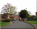
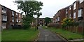
Living in LE7 7GU means inhabiting a compact, residential postcode area spanning 11.2 hectares, home to 2,232 people. With a population density of 1,930 people per square kilometre, this is a tightly knit community where proximity to amenities and services is a defining feature. The area’s character is shaped by its demographics: the median age is 47, with the majority of residents aged between 30 and 64. This suggests a stable, established population, many of whom are likely homeowners. The high home ownership rate (71%) and prevalence of houses over flats indicate a traditional, family-oriented environment. Daily life here is likely to revolve around local schools, retail hubs, and transport links, with the area’s small size ensuring that essential services are within easy reach. While the postcode is not linked to any protected natural sites, its safety profile is mixed, with low flood risk but a medium crime risk. For buyers, this balance of practicality and stability may appeal to those seeking a settled, community-focused lifestyle without the pressures of urban density.
- Area Type
- Postcode
- Area Size
- 11.2 hectares
- Population
- 2232
- Population Density
- 1930 people/km²
The property market in LE7 7GU is characterised by a high rate of home ownership (71%) and a dominance of houses over flats or apartments. This suggests a market skewed towards owner-occupied properties rather than rental or investment-focused housing. The prevalence of houses may appeal to families or individuals seeking larger, more permanent living spaces, though the area’s small size (11.2 hectares) means the housing stock is limited. Buyers should consider that the market is likely competitive, with limited availability of new builds or alternative property types. The compact nature of the postcode means that properties are closely clustered, which could be advantageous for those prioritising proximity to local amenities. However, the lack of data on property prices or recent transactions means it is difficult to assess whether the area is a buyer’s or seller’s market. For those seeking a traditional, low-density residential environment, LE7 7GU may offer a niche opportunity.
House Prices in LE7 7GU
Showing 1 properties
| Address | Type | Beds | Baths | Last Sale Price | Last Sale Date | |
|---|---|---|---|---|---|---|
| Severn Trent Water, Leicester Water Centre, Anstey Lane, Leicester, LE7 7GU | office_workshop | - | - | - | - |
Energy Efficiency in LE7 7GU
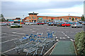
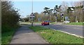
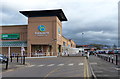
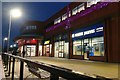
Life in LE7 7GU is supported by a range of nearby amenities that cater to daily needs and leisure. Retail options include Aldi Unit 10–11, Iceland Beaumont, and Tesco Leicester, offering a variety of shopping and grocery services. The area’s transport links, including Leicester North and Rothley metro stations, provide easy access to broader regional networks. For rail commuters, stations such as Leicester Railway Station and South Wigston Railway Station offer connections to major cities and towns. While the data does not specify parks or leisure facilities, the presence of multiple retail and transport hubs suggests a lifestyle focused on practicality and convenience. The compact nature of the postcode means that residents can access essentials without long journeys, though the lack of detailed information on green spaces or recreational areas may be a consideration for those prioritising outdoor activities.
Amenities
Schools
The schools near LE7 7GU include several primary schools and one academy. Buswells Lodge Primary School and English Martyrs Catholic School cater to younger children, while Beaumont Leys School holds a ‘good’ Ofsted rating, indicating a reliable standard of education. The presence of English Martyrs’ Catholic School, a voluntary academy, adds diversity to the educational options available. This mix of school types—state-funded primary schools and an academy—offers families flexibility in choosing between traditional and potentially more specialised curricula. The concentration of primary schools suggests that the area is well-suited for families with young children, reducing the need for long commutes to education. However, the absence of secondary schools in the data means that older students may need to travel further for secondary education. The quality of local schools is a key consideration for buyers prioritising family-friendly living.
| Rank | School | Type | Entry gender | Ages |
|---|
Explore more schools in this area
Go to Schools tabDemographics
The community in LE7 7GU is predominantly middle-aged, with a median age of 47 and the most common age range being 30–64 years. This suggests a mature, stable population, likely with long-term ties to the area. Home ownership is strong, with 71% of residents owning their homes, indicating a preference for long-term investment over rental living. The accommodation type is primarily houses, which aligns with the demographic profile of older, family-oriented households. The predominant ethnic group is White, though specific diversity metrics are not provided. The population density of 1,930 people per square kilometre implies a closely packed residential cluster, which may foster a sense of familiarity among residents. However, the data does not specify deprivation levels, so it is unclear how socioeconomic factors might influence quality of life. The mix of age groups and ownership patterns suggests a community that values stability and continuity, with limited turnover in housing.
Household Size
Accommodation Type
Tenure
Ethnic Group
Religion
Household Composition
Age
Household Deprivation
NS-SEC
Explore more demographic insights in this area
Go to Demographics tabPlanning
Planning Constraints
- Flood RiskPremium
- Ramsar Wetland SitesPremium
- Area of Outstanding Natural BeautyPremium
- Protected Nature ReservePremium
- Protected WoodlandPremium