Area Overview for LE7 7FL
Photos of LE7 7FL
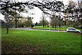
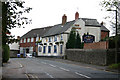

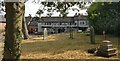
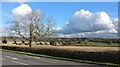
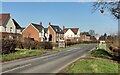
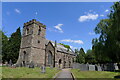
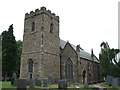

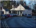

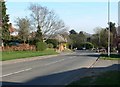
19 photos from this area
Area Information
Key information about the LE7 7FL including its size, population, and administrative classification.
- Area Type
- Postcode
- Area Size
- 1.3 hectares
- Population
- 1730
- Population Density
- 1155 people/km²
House Prices in LE7 7FL
28
Properties
£141,350
Average Sold Price
£39,000
Lowest Price
£280,000
Highest Price
Showing 28 properties
| Address | Type | Beds | Baths | Last Sale Price | Last Sale Date | |
|---|---|---|---|---|---|---|
| 70 Groby Road, Anstey, LE7 7FL | house | - | - | £280,000 | Feb 2023 | |
| 42 Groby Road, Anstey, LE7 7FL | Terraced | 2 | 1 | £237,500 | May 2022 | |
| 36 Groby Road, Anstey, LE7 7FL | house | - | - | £225,500 | Oct 2021 | |
| 4 Groby Road, Anstey, LE7 7FL | Terraced | 3 | 1 | £135,000 | May 2020 | |
| 68 Groby Road, Anstey, LE7 7FL | Semi-detached | 3 | 1 | £195,000 | Oct 2018 | |
| 8 Groby Road, Anstey, LE7 7FL | Terraced | 2 | - | £89,000 | Jul 2014 | |
| 54 Groby Road, Anstey, LE7 7FL | house | 3 | - | £120,000 | Oct 2011 | |
| 38 Groby Road, Anstey, LE7 7FL | house | 2 | - | £123,000 | Oct 2011 | |
| 12 Groby Road, Anstey, LE7 7FL | Bungalow | - | - | £134,000 | Oct 2009 | |
| 32 Groby Road, Anstey, LE7 7FL | Terraced | - | - | £150,000 | Aug 2005 |
Page 1 of 3
Energy Efficiency in LE7 7FL
Amenities
Schools
| Rank | School | Type | Entry gender | Ages |
|---|
Explore more schools in this area
Go to Schools tabDemographics
Household Size
One person
most common
Accommodation Type
Houses
most common
Tenure
67
majority
Ethnic Group
White
most common
Religion
N/A
most common
Household Composition
N/A
most common
Age
47
median
Adults (30-64 years)
most common
Household Deprivation
N/A
with no deprivation
NS-SEC
31
in Lower managerial occupations
Explore more demographic insights in this area
Go to Demographics tabPlanning
Planning Constraints
- Flood RiskPremium
- Ramsar Wetland SitesPremium
- Area of Outstanding Natural BeautyPremium
- Protected Nature ReservePremium
- Protected WoodlandPremium