Area Overview for LE7 4PL
Photos of LE7 4PL

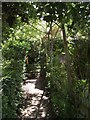
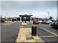
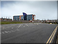
43 photos from this area
Area Information
Key information about the LE7 4PL including its size, population, and administrative classification.
- Area Type
- Postcode
- Area Size
- 35.1 hectares
- Population
- 2504
- Population Density
- 640 people/km²
House Prices in LE7 4PL
38
Properties
£434,286
Average Sold Price
£290,000
Lowest Price
£775,000
Highest Price
Showing 38 properties
| Address | Type | Beds | Baths | Last Sale Price | Last Sale Date | |
|---|---|---|---|---|---|---|
| 74 Rectory Road, Wanlip, LE7 4PL | house | - | - | £500,000 | Jul 2023 | |
| 47 Rectory Road, Wanlip, LE7 4PL | Detached | 4 | 2 | £510,000 | Jun 2022 | |
| 66-68 Rectory Road, Wanlip, LE7 4PL | Detached | 3 | 1 | £440,000 | Mar 2020 | |
| 51 Rectory Road, Wanlip, LE7 4PL | Detached | 6 | 4 | £775,000 | May 2019 | |
| 76 Rectory Road, Wanlip, LE7 4PL | Detached | 4 | - | £485,000 | Oct 2017 | |
| 82 Rectory Road, Wanlip, LE7 4PL | Detached | 4 | 2 | £445,000 | Jan 2017 | |
| 78 Rectory Road, Wanlip, LE7 4PL | Bungalow | 3 | 1 | £360,000 | Mar 2016 | |
| 64 Rectory Road, Wanlip, LE7 4PL | Cottage | 3 | 2 | £325,000 | Apr 2015 | |
| 41 Rectory Road, Wanlip, LE7 4PL | house | - | - | £385,000 | Sep 2014 | |
| 68A Rectory Road, Wanlip, LE7 4PL | Detached | 5 | 3 | £305,000 | Sep 2011 |
Page 1 of 4
Energy Efficiency in LE7 4PL
Amenities
Schools
| Rank | School | Type | Entry gender | Ages |
|---|
Explore more schools in this area
Go to Schools tabDemographics
Household Size
Family (3-5 people)
most common
Accommodation Type
Houses
most common
Tenure
66
majority
Ethnic Group
White
most common
Religion
N/A
most common
Household Composition
N/A
most common
Age
47
median
Adults (30-64 years)
most common
Household Deprivation
N/A
with no deprivation
NS-SEC
40
in Lower managerial occupations
Explore more demographic insights in this area
Go to Demographics tabPlanning
Planning Constraints
- Flood RiskPremium
- Ramsar Wetland SitesPremium
- Area of Outstanding Natural BeautyPremium
- Protected Nature ReservePremium
- Protected WoodlandPremium