Area Overview for LE7 3YW
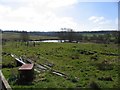
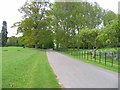
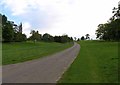
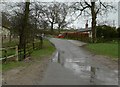
Photos of LE7 3YW


Area Information
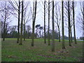
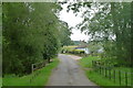
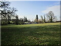
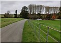
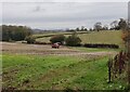
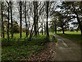
Living in LE7 3YW offers a quiet, residential experience with a small cluster of homes nestled in a low-density setting. The area’s population of 2979 residents, spread across 97 people per square kilometre, suggests a close-knit community where familiarity is common. This postcode is defined by its modest scale, with homes primarily built for long-term occupancy. Daily life here is likely characterised by a slower pace, with local amenities and schools within practical reach. The absence of major urban sprawl means residents can enjoy a balance between convenience and tranquillity. For those seeking a stable, family-friendly environment, LE7 3YW’s demographics—skewed towards adults aged 30–64—suggest a mature population with established routines. While the area lacks the vibrancy of larger towns, its small size ensures a sense of cohesion. Proximity to Syston Railway Station and Leicester Airport adds practical connectivity, while nearby shops and services cater to everyday needs. This is a place where comfort and simplicity take precedence over fast-paced living.
- Area Type
- Postcode
- Area Size
- Not available
- Population
- 2979
- Population Density
- 97 people/km²
The property market in LE7 3YW is dominated by owner-occupied homes, with 78% of properties in private hands. This high rate of home ownership suggests a stable market where residents are likely to stay for extended periods. The accommodation type is predominantly houses, which may appeal to those seeking larger living spaces or a more traditional housing layout. As a small residential cluster, the area’s property stock is limited, meaning buyers should consider nearby regions for broader options. The focus on owner-occupied housing indicates a community with long-term residents, which can create a sense of continuity and stability. However, the limited scale of the area may also mean fewer property choices, requiring buyers to be selective. For those prioritising a quiet, family-friendly environment, the existing housing stock offers a practical foundation, though expansion opportunities are constrained by the area’s compact nature.
House Prices in LE7 3YW
No properties found in this postcode.
Energy Efficiency in LE7 3YW
The lifestyle in LE7 3YW is shaped by its small-scale amenities and proximity to essential services. Residents can access five retail outlets, including M&S Branston BP, Morrisons Daily, and Co-op Scraptoft, offering a range of shopping options for groceries, fuel, and daily essentials. The Syston Railway Station and Leicester Airport provide connectivity to broader destinations, though the area itself lacks major leisure or entertainment facilities. The absence of parks or recreational spaces in the data suggests a focus on practical living rather than leisure. However, the nearby schools and retail options create a self-contained environment for families. The low population density and mature demographic contribute to a relaxed pace of life, where community ties are likely strong. While the area may not cater to those seeking vibrant nightlife, it offers a simple, functional lifestyle with minimal need for travel beyond immediate needs.
Amenities
Schools
Residents of LE7 3YW have access to two primary schools, both of which are notable for their quality. The Pochin School serves as both a primary and academy, achieving an outstanding Ofsted rating, which highlights its excellence in education. Queniborough Church of England Primary School, also a primary school, holds a good Ofsted rating, ensuring reliable standards for younger students. The presence of two primary schools within reach provides families with options, though the lack of secondary schools nearby may require commuting. The mix of school types—specifically the academy model—suggests a focus on structured, high-quality education. For families prioritising academic outcomes, The Pochin School’s outstanding rating is a significant advantage. However, the absence of data on secondary education means parents should consider proximity to larger towns for comprehensive schooling.
| Rank | School | Type | Entry gender | Ages |
|---|
Explore more schools in this area
Go to Schools tabDemographics
The community in LE7 3YW is predominantly composed of adults aged 30–64, with a median age of 47. This suggests a population that is largely settled, with fewer young families or elderly residents compared to other areas. Home ownership is high, at 78%, indicating a strong presence of long-term residents who have invested in their properties. The accommodation type is primarily houses, which aligns with the area’s residential character and may contribute to a more private living experience. The predominant ethnic group is White, reflecting a homogenous demographic profile. With a population density of 97 people per square kilometre, the area avoids overcrowding, offering a balance between community interaction and personal space. The absence of specific data on deprivation or diversity means the quality of life here is likely shaped by the stability of its mature population and the availability of local services.
Household Size
Accommodation Type
Tenure
Ethnic Group
Religion
Household Composition
Age
Household Deprivation
NS-SEC
Explore more demographic insights in this area
Go to Demographics tabPlanning
Planning Constraints
- Flood RiskPremium
- Ramsar Wetland SitesPremium
- Area of Outstanding Natural BeautyPremium
- Protected Nature ReservePremium
- Protected WoodlandPremium