Area Overview for LE7 3XB
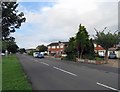
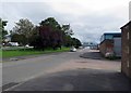
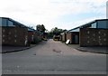
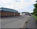
Photos of LE7 3XB


Area Information
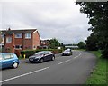
Living in LE7 3XB offers a quiet, residential experience in a small cluster of homes with a population of just 1,315. The area is defined by its mature demographic, with a median age of 47 and a majority of residents aged 30–64. This suggests a community of established families and professionals, reflected in the high home ownership rate of 84%. The area’s compact size means it is likely surrounded by open countryside or rural infrastructure, though specific details about its geography are not provided. Residents benefit from low crime risk, with a safety score of 79, and no environmental hazards such as flood zones or protected natural sites. Nearby, Broomfield Community Primary School provides a solid educational foundation for families, while rail and metro links offer connectivity to larger towns. The mix of retail options, including Morrisons and Iceland, ensures daily conveniences are within reach. LE7 3XB is ideal for those seeking a stable, low-risk environment with practical amenities and a strong sense of community.
- Area Type
- Postcode
- Area Size
- Not available
- Population
- 1315
- Population Density
- 4632 people/km²
The property market in LE7 3XB is dominated by owner-occupied homes, with 84% of residents living in properties they own. The accommodation type is exclusively houses, which is unusual in areas with higher flats or apartments. This suggests a rural or semi-rural setting, where larger homes are the norm. The small population of 1,315 indicates a limited housing stock, which may mean fewer options for buyers but could also imply a strong sense of community and less competition. The high home ownership rate suggests that properties here are likely to be long-term investments rather than short-term rentals. Buyers should consider the proximity to amenities such as schools and transport links, which are critical in such a small area. The lack of flats or apartments may appeal to those seeking spacious, family-friendly homes but could limit options for those prioritising urban living.
House Prices in LE7 3XB
No properties found in this postcode.
Energy Efficiency in LE7 3XB
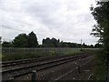
The lifestyle in LE7 3XB is shaped by its proximity to practical amenities, including five retail outlets such as Morrisons Daily, Iceland Leicester, and M&S Branston BP. These shops provide essential services for daily living, from groceries to household goods. The rail network, with stations at Syston, Sileby, and Barrow upon Soar, offers access to broader regional hubs, while metro stops like Rothley and Leicester North enhance connectivity. Though the data does not mention parks or leisure facilities, the absence of environmental constraints like protected woodlands or wetlands suggests open spaces may be available nearby. The area’s small size means that residents can access these amenities without long commutes, fostering a convenient, self-contained lifestyle. The mix of retail and transport options supports both practical needs and social mobility, making LE7 3XB appealing for those prioritising accessibility and simplicity.
Amenities
Schools
The nearest school to LE7 3XB is Broomfield Community Primary School, which serves the local area and holds an Ofsted rating of ‘good’. This primary school is the only educational institution listed in the data, indicating that families in the area must rely on this single school for early education. The absence of secondary schools or additional educational facilities suggests that parents may need to look beyond LE7 3XB for secondary schooling, though the nearby rail and metro links could provide access to larger towns with more comprehensive schools. The ‘good’ rating at Broomfield Community Primary School is a positive sign for families, offering a reliable foundation for children’s education. However, the limited range of schools in the immediate vicinity means that prospective buyers should consider proximity to other educational resources when evaluating the area.
| Rank | School | Type | Entry gender | Ages |
|---|
Explore more schools in this area
Go to Schools tabDemographics
The community in LE7 3XB is predominantly composed of adults aged 30–64, with a median age of 47. This suggests a population of middle-aged residents, many of whom are likely to be long-term residents or families with established roots. Home ownership is exceptionally high at 84%, indicating a stable, owner-occupied area rather than a rental market. The accommodation type is primarily houses, which aligns with the area’s small, residential character. The predominant ethnic group is White, though no data on diversity or deprivation levels is provided. This demographic profile implies a community focused on long-term living rather than transient populations. The low crime risk score of 79 further supports the notion of a safe, settled environment. For buyers, this suggests a neighbourhood where property values are likely to hold their value, and where residents are invested in maintaining local stability.
Household Size
Accommodation Type
Tenure
Ethnic Group
Religion
Household Composition
Age
Household Deprivation
NS-SEC
Explore more demographic insights in this area
Go to Demographics tabPlanning
Planning Constraints
- Flood RiskPremium
- Ramsar Wetland SitesPremium
- Area of Outstanding Natural BeautyPremium
- Protected Nature ReservePremium
- Protected WoodlandPremium