Area Overview for LE7 3QG
Photos of LE7 3QG
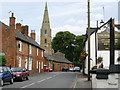
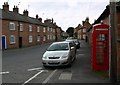
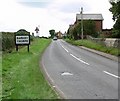
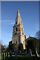
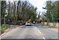
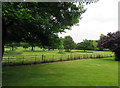
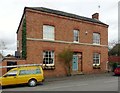
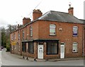
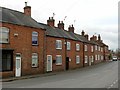
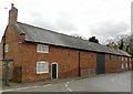
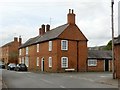
74 photos from this area
Area Information
Key information about the LE7 3QG including its size, population, and administrative classification.
- Area Type
- Postcode
- Area Size
- 46.7 hectares
- Population
- 2979
- Population Density
- 97 people/km²
House Prices in LE7 3QG
43
Properties
£311,097
Average Sold Price
£105,000
Lowest Price
£650,000
Highest Price
Showing 43 properties
| Address | Type | Beds | Baths | Last Sale Price | Last Sale Date | |
|---|---|---|---|---|---|---|
| 13 Main Street, Barkby, LE7 3QG | Cottage | 3 | 1 | £190,000 | Aug 2024 | |
| 31 Main Street, Barkby, LE7 3QG | house | - | - | £350,000 | Apr 2024 | |
| Brooklands Farmhouse, 38 Main Street, Barkby, LE7 3QG | Detached | 5 | 2 | £432,500 | Dec 2023 | |
| 11 Main Street, Barkby, LE7 3QG | Terraced | 4 | 1 | £153,000 | Feb 2021 | |
| 48 Main Street, Barkby, LE7 3QG | Detached | 4 | 1 | £585,000 | Aug 2017 | |
| 49 Main Street, Barkby, LE7 3QG | house | 4 | - | £650,000 | Apr 2017 | |
| 35 Main Street, Barkby, LE7 3QG | Detached | 4 | - | £545,000 | Oct 2013 | |
| 25 Main Street, Barkby, LE7 3QG | Detached | 4 | - | £272,000 | Aug 2013 | |
| 9 Main Street, Barkby, LE7 3QG | Terraced | 2 | 1 | £130,000 | Oct 2009 | |
| 5 Main Street, Barkby, LE7 3QG | Terraced | 2 | 1 | £129,950 | Apr 2005 |
Page 1 of 5
Energy Efficiency in LE7 3QG
Amenities
Schools
| Rank | School | Type | Entry gender | Ages |
|---|
Explore more schools in this area
Go to Schools tabDemographics
Household Size
Family (3-5 people)
most common
Accommodation Type
Houses
most common
Tenure
78
majority
Ethnic Group
White
most common
Religion
N/A
most common
Household Composition
N/A
most common
Age
47
median
Adults (30-64 years)
most common
Household Deprivation
N/A
with no deprivation
NS-SEC
42
in Lower managerial occupations
Explore more demographic insights in this area
Go to Demographics tabPlanning
Planning Constraints
- Flood RiskPremium
- Ramsar Wetland SitesPremium
- Area of Outstanding Natural BeautyPremium
- Protected Nature ReservePremium
- Protected WoodlandPremium