Area Overview for LE7 2AY
Photos of LE7 2AY
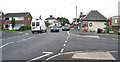
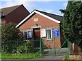
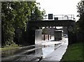
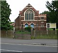
100 photos from this area
Area Information
Key information about the LE7 2AY including its size, population, and administrative classification.
- Area Type
- Postcode
- Area Size
- 1.5 hectares
- Population
- 1229
- Population Density
- 5605 people/km²
House Prices in LE7 2AY
30
Properties
£163,721
Average Sold Price
£45,000
Lowest Price
£300,000
Highest Price
Showing 30 properties
| Address | Type | Beds | Baths | Last Sale Price | Last Sale Date | |
|---|---|---|---|---|---|---|
| 7 University Close, Syston, LE7 2AY | Semi-detached | 2 | 1 | £270,000 | Sep 2024 | |
| 23 University Close, Syston, LE7 2AY | Bungalow | 3 | 1 | £270,000 | Jul 2024 | |
| 8 University Close, Syston, LE7 2AY | Bungalow | 2 | 1 | £260,000 | May 2024 | |
| 29 University Close, Syston, LE7 2AY | Retail | 2 | 1 | £207,000 | Mar 2022 | |
| 11A University Close, Syston, LE7 2AY | Bungalow | - | - | £300,000 | Aug 2021 | |
| 15 University Close, Syston, LE7 2AY | Bungalow | 2 | - | £166,800 | Dec 2016 | |
| 2 University Close, Syston, LE7 2AY | Bungalow | - | - | £138,000 | Feb 2015 | |
| 9 University Close, Syston, LE7 2AY | Detached | 2 | 1 | £131,000 | May 2013 | |
| 5 University Close, Syston, LE7 2AY | Detached | 2 | 1 | £125,000 | Oct 2012 | |
| 6 University Close, Syston, LE7 2AY | Semi-detached | - | - | £184,950 | Apr 2007 |
Page 1 of 3
Energy Efficiency in LE7 2AY
Amenities
Schools
| Rank | School | Type | Entry gender | Ages |
|---|
Explore more schools in this area
Go to Schools tabDemographics
Household Size
Two person
most common
Accommodation Type
Houses
most common
Tenure
88
majority
Ethnic Group
White
most common
Religion
N/A
most common
Household Composition
N/A
most common
Age
47
median
Adults (30-64 years)
most common
Household Deprivation
N/A
with no deprivation
NS-SEC
32
in Lower managerial occupations
Explore more demographic insights in this area
Go to Demographics tabPlanning
Planning Constraints
- Flood RiskPremium
- Ramsar Wetland SitesPremium
- Area of Outstanding Natural BeautyPremium
- Protected Nature ReservePremium
- Protected WoodlandPremium