Area Overview for LE7 1HW
Photos of LE7 1HW
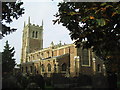
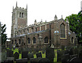
100 photos from this area
Area Information
Key information about the LE7 1HW including its size, population, and administrative classification.
- Area Type
- Postcode
- Area Size
- 2.1 hectares
- Population
- 1400
- Population Density
- 2250 people/km²
House Prices in LE7 1HW
34
Properties
£217,652
Average Sold Price
£74,500
Lowest Price
£450,000
Highest Price
Showing 34 properties
| Address | Type | Beds | Baths | Last Sale Price | Last Sale Date | |
|---|---|---|---|---|---|---|
| 34 Northfields, Syston, LE7 1HW | house | 5 | 2 | £440,000 | Jan 2025 | |
| 26 Northfields, Syston, LE7 1HW | Detached | - | - | £450,000 | Nov 2023 | |
| 1 Northfields, Syston, LE7 1HW | Retail | 3 | 1 | £317,500 | Feb 2022 | |
| 16 Northfields, Syston, LE7 1HW | house | - | - | £415,000 | Jan 2021 | |
| 15 Northfields, Syston, LE7 1HW | Bungalow | 3 | 1 | £275,000 | Jun 2020 | |
| 7 Northfields, Syston, LE7 1HW | Detached | 4 | 1 | £320,000 | Nov 2019 | |
| 3 Northfields, Syston, LE7 1HW | Detached | 5 | 2 | £250,000 | Sep 2019 | |
| 24 Northfields, Syston, LE7 1HW | house | 3 | - | £195,000 | Feb 2019 | |
| 30 Northfields, Syston, LE7 1HW | Bungalow | - | - | £225,000 | Jul 2018 | |
| 2 Northfields, Syston, LE7 1HW | Detached | 6 | 3 | £363,000 | Mar 2018 |
Page 1 of 4
Energy Efficiency in LE7 1HW
Amenities
Schools
| Rank | School | Type | Entry gender | Ages |
|---|
Explore more schools in this area
Go to Schools tabDemographics
Household Size
One person
most common
Accommodation Type
Houses
most common
Tenure
60
majority
Ethnic Group
White
most common
Religion
N/A
most common
Household Composition
N/A
most common
Age
47
median
Adults (30-64 years)
most common
Household Deprivation
N/A
with no deprivation
NS-SEC
28
in Lower managerial occupations
Explore more demographic insights in this area
Go to Demographics tabPlanning
Planning Constraints
- Flood RiskPremium
- Ramsar Wetland SitesPremium
- Area of Outstanding Natural BeautyPremium
- Protected Nature ReservePremium
- Protected WoodlandPremium