Area Overview for LE7 1HG
Photos of LE7 1HG


Area Information
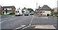
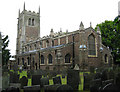
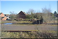
LE7 1HG is a small, tightly knit residential postcode area in England, home to around 1,893 people. Its compact size fosters a close-knit community feel, with homes predominantly in the form of houses rather than flats. The area’s demographics suggest a mature population, with a median age of 47 and most residents falling within the 30-64 age range. This hints at a stable, established community with strong local ties. Daily life here is likely characterised by a mix of quiet domesticity and easy access to nearby amenities. The proximity to four railway stations, including Syston and Sileby, means residents have straightforward connections to larger towns and cities. For those prioritising convenience, the area’s retail options—such as Aldi Syston and Tesco Syston—offer practical shopping choices. While the population is small, the presence of multiple rail links and local services suggests a balance between seclusion and accessibility, making LE7 1HG appealing to those seeking a settled, low-stress lifestyle without complete isolation from urban hubs.
- Area Type
- Postcode
- Area Size
- Not available
- Population
- 1893
- Population Density
- 1940 people/km²
The property market in LE7 1HG is defined by a high rate of home ownership—61% of properties are owner-occupied—suggesting a community of long-term residents rather than transient renters. The accommodation type is predominantly houses, which is unusual for smaller postcode areas that often include more flats or terraced housing. This indicates a focus on standalone homes, likely appealing to families or individuals prioritising privacy and space. Given the small population and limited housing stock, the market is likely to be niche, with properties in high demand from those seeking a quiet, established environment. Buyers should consider that the area’s size restricts availability, and competition may be fierce. For those interested in investment, the low crime risk and stable demographics could offer long-term security, though the lack of large-scale development suggests limited scope for capital growth.
House Prices in LE7 1HG
No properties found in this postcode.
Energy Efficiency in LE7 1HG
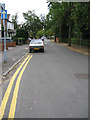
Living in LE7 1HG offers a blend of practicality and convenience, with nearby amenities catering to daily needs. The area’s retail options include Aldi Syston, Tesco Syston, and Spar, providing essential shopping without the need to travel far. For commuters, the proximity to Syston Railway Station and other nearby stops ensures easy access to larger towns like Leicester, which hosts a wider range of services and cultural attractions. While the area itself is small, the rail links open up opportunities for leisure, work, and socialising beyond the immediate postcode. The absence of major parks or leisure facilities within LE7 1HG means residents may need to travel slightly further for outdoor activities, but the nearby towns offer alternatives. Overall, the lifestyle here is characterised by simplicity: a focus on local essentials, reliable transport, and a community-oriented environment that prioritises ease and stability over sprawling urban amenities.
Amenities
Schools
| Rank | School | Type | Entry gender | Ages |
|---|
Explore more schools in this area
Go to Schools tabDemographics
The population of LE7 1HG skews towards adults aged 30-64, with a median age of 47. This suggests a community of established professionals and families, many of whom are likely to have built their homes rather than rented. Home ownership here is strong, with 61% of properties owned by residents, compared to the national average of around 68%. The predominant accommodation type is houses, which aligns with the area’s small, residential character. The predominant ethnic group is White, reflecting a demographic profile typical of many small English towns. While no data is provided on deprivation levels, the high home ownership and age profile suggest a relatively stable economic environment. This stability may contribute to a sense of continuity, with residents likely to have lived in the area for years or decades. The absence of significant demographic diversity, however, means the community’s cultural and social dynamics are relatively homogenous.
Household Size
Accommodation Type
Tenure
Ethnic Group
Religion
Household Composition
Age
Household Deprivation
NS-SEC
Explore more demographic insights in this area
Go to Demographics tabPlanning
Planning Constraints
- Flood RiskPremium
- Ramsar Wetland SitesPremium
- Area of Outstanding Natural BeautyPremium
- Protected Nature ReservePremium
- Protected WoodlandPremium