Area Overview for LE7 1GJ
Photos of LE7 1GJ
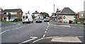
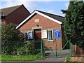
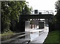
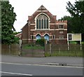
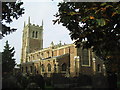
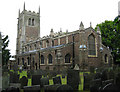
100 photos from this area
Area Information
Key information about the LE7 1GJ including its size, population, and administrative classification.
- Area Type
- Postcode
- Area Size
- 5111 m²
- Population
- 1893
- Population Density
- 1940 people/km²
House Prices in LE7 1GJ
23
Properties
£164,685
Average Sold Price
£64,950
Lowest Price
£249,950
Highest Price
Showing 23 properties
| Address | Type | Beds | Baths | Last Sale Price | Last Sale Date | |
|---|---|---|---|---|---|---|
| 83 Broad Street, Syston, LE7 1GJ | Semi-detached | 4 | 2 | £240,000 | Dec 2024 | |
| 93 Broad Street, Syston, LE7 1GJ | Terraced | 3 | 1 | £249,950 | Jun 2020 | |
| 89 Broad Street, Syston, LE7 1GJ | Industrial | 3 | 1 | £212,000 | Jan 2017 | |
| 87 Broad Street, Syston, LE7 1GJ | Terraced | 4 | 2 | £194,950 | Jul 2014 | |
| 97 Broad Street, Syston, LE7 1GJ | Terraced | 3 | 1 | £109,000 | Dec 2012 | |
| 107 Broad Street, Syston, LE7 1GJ | house | 3 | - | £158,000 | Nov 2010 | |
| 85 Broad Street, Syston, LE7 1GJ | Terraced | - | - | £177,000 | Mar 2006 | |
| 101 Broad Street, Syston, LE7 1GJ | Terraced | 3 | 1 | £127,000 | Sep 2005 | |
| 103 Broad Street, Syston, LE7 1GJ | Semi-detached | 3 | 1 | £114,000 | Jul 2003 | |
| 105 Broad Street, Syston, LE7 1GJ | Terraced | - | - | £64,950 | May 2001 |
Page 1 of 3
Energy Efficiency in LE7 1GJ
Amenities
Schools
| Rank | School | Type | Entry gender | Ages |
|---|
Explore more schools in this area
Go to Schools tabDemographics
Household Size
One person
most common
Accommodation Type
Houses
most common
Tenure
61
majority
Ethnic Group
White
most common
Religion
N/A
most common
Household Composition
N/A
most common
Age
47
median
Adults (30-64 years)
most common
Household Deprivation
N/A
with no deprivation
NS-SEC
30
in Lower managerial occupations
Explore more demographic insights in this area
Go to Demographics tabPlanning
Planning Constraints
- Flood RiskPremium
- Ramsar Wetland SitesPremium
- Area of Outstanding Natural BeautyPremium
- Protected Nature ReservePremium
- Protected WoodlandPremium