Area Overview for LE67 9PQ
Photos of LE67 9PQ
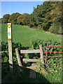

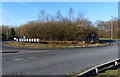
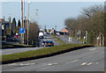
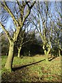
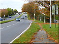
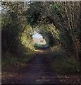

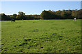
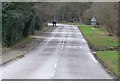

12 photos from this area
Area Information
Key information about the LE67 9PQ including its size, population, and administrative classification.
- Area Type
- Postcode
- Area Size
- 18.8 hectares
- Population
- 1573
- Population Density
- 247 people/km²
House Prices in LE67 9PQ
29
Properties
£442,622
Average Sold Price
£77,000
Lowest Price
£750,000
Highest Price
Showing 29 properties
| Address | Type | Beds | Baths | Last Sale Price | Last Sale Date | |
|---|---|---|---|---|---|---|
| 237 Markfield Lane, Newtown Linford, LE67 9PQ | Semi-detached | 4 | 2 | £480,000 | Dec 2025 | |
| 201 Markfield Lane, Newtown Linford, LE67 9PQ | Detached | 3 | 2 | £476,500 | Sep 2025 | |
| 187 Markfield Lane, Newtown Linford, LE67 9PQ | house | 5 | 4 | £750,000 | Feb 2025 | |
| 213 Markfield Lane, Newtown Linford, LE67 9PQ | Detached | 4 | 3 | £540,000 | Nov 2024 | |
| 197 Markfield Lane, Newtown Linford, LE67 9PQ | Semi-detached | 3 | 1 | £380,000 | Sep 2023 | |
| 189A Markfield Lane, Newtown Linford, LE67 9PQ | Bungalow | 3 | 2 | £607,000 | Jan 2023 | |
| 199 Markfield Lane, Newtown Linford, LE67 9PQ | house | - | - | £452,000 | Mar 2022 | |
| 211 Markfield Lane, Newtown Linford, LE67 9PQ | Bungalow | 3 | 2 | £645,000 | Sep 2021 | |
| 223 Markfield Lane, Newtown Linford, LE67 9PQ | house | - | - | £384,500 | Mar 2021 | |
| 241 Markfield Lane, Newtown Linford, LE67 9PQ | house | - | - | £255,000 | Mar 2019 |
Page 1 of 3
Energy Efficiency in LE67 9PQ
Amenities
Schools
| Rank | School | Type | Entry gender | Ages |
|---|
Explore more schools in this area
Go to Schools tabDemographics
Household Size
Two person
most common
Accommodation Type
Houses
most common
Tenure
73
majority
Ethnic Group
White
most common
Religion
N/A
most common
Household Composition
N/A
most common
Age
47
median
Adults (30-64 years)
most common
Household Deprivation
N/A
with no deprivation
NS-SEC
32
in Lower managerial occupations
Explore more demographic insights in this area
Go to Demographics tabPlanning
Planning Constraints
- Flood RiskPremium
- Ramsar Wetland SitesPremium
- Area of Outstanding Natural BeautyPremium
- Protected Nature ReservePremium
- Protected WoodlandPremium