Area Overview for LE67 6JP
Photos of LE67 6JP
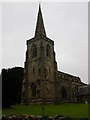
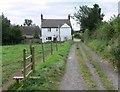
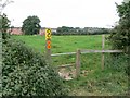
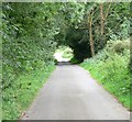
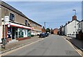
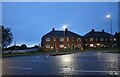
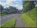
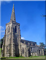
26 photos from this area
Area Information
Key information about the LE67 6JP including its size, population, and administrative classification.
- Area Type
- Postcode
- Area Size
- 1.8 hectares
- Population
- 1816
- Population Density
- 649 people/km²
House Prices in LE67 6JP
20
Properties
£158,227
Average Sold Price
£41,500
Lowest Price
£290,000
Highest Price
Showing 20 properties
| Address | Type | Beds | Baths | Last Sale Price | Last Sale Date | |
|---|---|---|---|---|---|---|
| 146 High Street, Ibstock, LE67 6JP | Terraced | 2 | 1 | £122,000 | Jul 2024 | |
| 148 High Street, Ibstock, LE67 6JP | house | 2 | 1 | £164,995 | Mar 2024 | |
| 122 High Street, Ibstock, LE67 6JP | Detached | 4 | 2 | £290,000 | Feb 2024 | |
| 126 High Street, Ibstock, LE67 6JP | house | - | - | £170,000 | Jan 2023 | |
| 166 High Street, Ibstock, LE67 6JP | Retail | 3 | 1 | £237,000 | Oct 2022 | |
| 140 High Street, Ibstock, LE67 6JP | house | 2 | 2 | £140,000 | May 2021 | |
| 124 High Street, Ibstock, LE67 6JP | Terraced | - | - | £110,000 | Feb 2006 | |
| 158 High Street, Ibstock, LE67 6JP | Detached | - | - | £120,000 | Mar 2003 | |
| 154 High Street, Ibstock, LE67 6JP | Unknown | - | - | £145,000 | Mar 2003 | |
| The Old Crown, 176 High Street, Ibstock, LE67 6JP | house | - | - | £200,000 | Jul 2000 |
Page 1 of 2
Energy Efficiency in LE67 6JP
Amenities
Schools
| Rank | School | Type | Entry gender | Ages |
|---|
Explore more schools in this area
Go to Schools tabDemographics
Household Size
Two person
most common
Accommodation Type
Houses
most common
Tenure
54
majority
Ethnic Group
White
most common
Religion
N/A
most common
Household Composition
N/A
most common
Age
47
median
Adults (30-64 years)
most common
Household Deprivation
N/A
with no deprivation
NS-SEC
22
in Lower managerial occupations
Explore more demographic insights in this area
Go to Demographics tabPlanning
Planning Constraints
- Flood RiskPremium
- Ramsar Wetland SitesPremium
- Area of Outstanding Natural BeautyPremium
- Protected Nature ReservePremium
- Protected WoodlandPremium