Area Overview for LE67 5AX
Photos of LE67 5AX
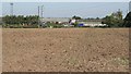

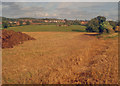
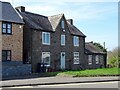


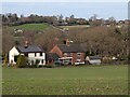
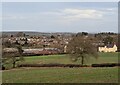
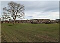
25 photos from this area
Area Information
Key information about the LE67 5AX including its size, population, and administrative classification.
- Area Type
- Postcode
- Area Size
- 6.7 hectares
- Population
- 1444
- Population Density
- 2812 people/km²
House Prices in LE67 5AX
39
Properties
£156,368
Average Sold Price
£20,000
Lowest Price
£400,000
Highest Price
Showing 39 properties
| Address | Type | Beds | Baths | Last Sale Price | Last Sale Date | |
|---|---|---|---|---|---|---|
| 81 Talbot Street, Whitwick, LE67 5AX | Semi-detached | 4 | 1 | £230,000 | Aug 2025 | |
| 133 Talbot Street, Whitwick, LE67 5AX | Detached | 5 | 2 | £400,000 | Aug 2025 | |
| 101 Talbot Street, Whitwick, LE67 5AX | Terraced | 2 | 1 | £142,000 | May 2024 | |
| 105 Talbot Street, Whitwick, LE67 5AX | Terraced | 2 | 1 | £162,000 | Oct 2022 | |
| 69 Talbot Street, Whitwick, LE67 5AX | Semi-detached | 4 | 2 | £187,000 | Nov 2020 | |
| Spring Cottage, 131 Talbot Street, Whitwick, LE67 5AX | Detached | 3 | 2 | £248,000 | Oct 2020 | |
| 31 Talbot Street, Whitwick, LE67 5AX | Semi-detached | 2 | - | £165,000 | Sep 2020 | |
| 95 Talbot Street, Whitwick, LE67 5AX | Detached | 2 | 1 | £115,000 | Oct 2019 | |
| 109 Talbot Street, Whitwick, LE67 5AX | Detached | 4 | 3 | £272,000 | May 2018 | |
| 89 Talbot Street, Whitwick, LE67 5AX | Semi-detached | 2 | 1 | £170,000 | Oct 2017 |
Page 1 of 4
Energy Efficiency in LE67 5AX
Amenities
Schools
| Rank | School | Type | Entry gender | Ages |
|---|
Explore more schools in this area
Go to Schools tabDemographics
Household Size
Two person
most common
Accommodation Type
Houses
most common
Tenure
84
majority
Ethnic Group
White
most common
Religion
N/A
most common
Household Composition
N/A
most common
Age
47
median
Adults (30-64 years)
most common
Household Deprivation
N/A
with no deprivation
NS-SEC
29
in Lower managerial occupations
Explore more demographic insights in this area
Go to Demographics tabPlanning
Planning Constraints
- Flood RiskPremium
- Ramsar Wetland SitesPremium
- Area of Outstanding Natural BeautyPremium
- Protected Nature ReservePremium
- Protected WoodlandPremium