Area Overview for LE67 3LD
Photos of LE67 3LD
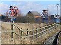
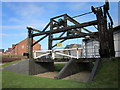
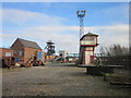

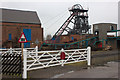
48 photos from this area
Area Information
Key information about the LE67 3LD including its size, population, and administrative classification.
- Area Type
- Postcode
- Area Size
- 1.5 hectares
- Population
- 2202
- Population Density
- 2931 people/km²
House Prices in LE67 3LD
37
Properties
£104,489
Average Sold Price
£35,500
Lowest Price
£195,000
Highest Price
Showing 37 properties
| Address | Type | Beds | Baths | Last Sale Price | Last Sale Date | |
|---|---|---|---|---|---|---|
| 210 Ashby Road, Coalville, LE67 3LD | Terraced | 2 | 1 | £161,335 | Aug 2025 | |
| 248 Ashby Road, Coalville, LE67 3LD | Semi-detached | 3 | 1 | £195,000 | Aug 2025 | |
| 198 Ashby Road, Coalville, LE67 3LD | Terraced | 2 | 1 | £110,000 | Apr 2025 | |
| 208 Ashby Road, Coalville, LE67 3LD | Terraced | 2 | 1 | £140,000 | May 2023 | |
| 212 Ashby Road, Coalville, LE67 3LD | Terraced | 3 | 1 | £170,000 | Nov 2022 | |
| 256 Ashby Road, Coalville, LE67 3LD | Detached | 3 | 1 | £171,000 | Sep 2021 | |
| 192 Ashby Road, Coalville, LE67 3LD | Terraced | 1 | 2 | £118,000 | Aug 2021 | |
| 234 Ashby Road, Coalville, LE67 3LD | house | - | - | £112,500 | May 2021 | |
| 236 Ashby Road, Coalville, LE67 3LD | Terraced | 3 | 1 | £145,000 | Feb 2021 | |
| 194 Ashby Road, Coalville, LE67 3LD | Terraced | 3 | 1 | £110,000 | Dec 2019 |
Page 1 of 4
Energy Efficiency in LE67 3LD
Amenities
Schools
| Rank | School | Type | Entry gender | Ages |
|---|
Explore more schools in this area
Go to Schools tabDemographics
Household Size
Two person
most common
Accommodation Type
Houses
most common
Tenure
76
majority
Ethnic Group
White
most common
Religion
N/A
most common
Household Composition
N/A
most common
Age
47
median
Adults (30-64 years)
most common
Household Deprivation
N/A
with no deprivation
NS-SEC
30
in Lower managerial occupations
Explore more demographic insights in this area
Go to Demographics tabPlanning
Planning Constraints
- Flood RiskPremium
- Ramsar Wetland SitesPremium
- Area of Outstanding Natural BeautyPremium
- Protected Nature ReservePremium
- Protected WoodlandPremium