Area Overview for LE67 2DA
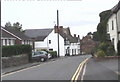
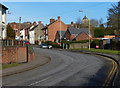
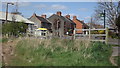
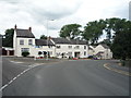
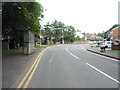
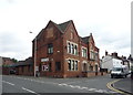
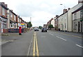
Photos of LE67 2DA


Area Information
Living in LE67 2DA means inhabiting a compact, residential cluster in England’s heartland. The area covers 5,708 square metres, housing 2,325 people in a dense layout with 1,215 residents per square kilometre. This small postcode is characterised by a mature demographic, with a median age of 47 and most residents aged between 30 and 64. The community is predominantly home-owning, with 83% of properties occupied by owners, and housing is largely composed of individual homes rather than flats. Daily life here is shaped by proximity to essential services, including a railway station and a selection of local shops. While the area lacks sprawling green spaces, its compact nature ensures amenities are within walking distance. The absence of major environmental constraints, such as protected woodlands or areas of outstanding natural beauty, means development is not restricted by planning limitations. For buyers, this represents a pragmatic, low-risk environment with straightforward access to infrastructure, though the small size means limited housing options for expansion.
- Area Type
- Postcode
- Area Size
- 5708 m²
- Population
- 2325
- Population Density
- 1215 people/km²
The property market in LE67 2DA is dominated by owner-occupied homes, with 83% of properties in private hands. This contrasts with areas where rental demand drives the market, indicating a community of long-term residents rather than transient tenants. The accommodation type is primarily houses, which is unusual for a small postcode but may reflect the area’s rural or semi-rural character. Given the compact size of 5,708 square metres, the housing stock is limited, meaning buyers must consider proximity to the area or its immediate surroundings. The high home ownership rate suggests limited turnover, which could make property searches challenging. For those seeking a home here, the focus would be on individual homes rather than flats, with potential for long-term value retention. However, the small scale of the area means buyers must evaluate whether the available properties meet their specific needs.
House Prices in LE67 2DA
Showing 18 properties
| Address | Type | Beds | Baths | Last Sale Price | Last Sale Date | |
|---|---|---|---|---|---|---|
| 4 Wainwright Road, Hugglescote, LE67 2DA | Detached | 4 | 2 | £405,000 | Feb 2025 | |
| 3 Wainwright Road, Hugglescote, LE67 2DA | house | 4 | 2 | £245,000 | May 2018 | |
| 1 Wainwright Road, Hugglescote, LE67 2DA | Detached | 3 | - | £285,000 | May 2017 | |
| 2 Wainwright Road, Hugglescote, LE67 2DA | house | - | - | £235,000 | Sep 2013 | |
| 6 Wainwright Road, Hugglescote, LE67 2DA | house | 4 | - | £224,000 | Sep 2011 | |
| 8 Wainwright Road, Hugglescote, LE67 2DA | Detached | - | - | £109,950 | Jun 1998 | |
| 28 Wainwright Road, Hugglescote, LE67 2DA | Detached | - | - | - | - | |
| 14 Wainwright Road, Hugglescote, LE67 2DA | Detached | - | - | - | - | |
| 26 Wainwright Road, Hugglescote, LE67 2DA | Semi-detached | - | - | - | - | |
| 18 Wainwright Road, Hugglescote, LE67 2DA | Detached | - | - | - | - |
Energy Efficiency in LE67 2DA
Residents of LE67 2DA benefit from a range of nearby amenities within practical reach. The retail sector includes five local shops, with notable names such as Morrisons Daily, Co-op Oak, and Spar, ensuring access to groceries and everyday essentials. The presence of Shackerstone Railway Station adds to the area’s connectivity, enabling travel to nearby towns for shopping, dining, or leisure. While the data does not mention parks or recreational facilities, the compact layout suggests that local amenities are designed for convenience rather than expansive leisure options. The mix of retail and transport infrastructure supports a self-sufficient lifestyle, with minimal need to travel beyond the immediate vicinity. For families, the proximity of schools and shops creates a cohesive environment where daily errands and routines can be managed efficiently.
Amenities
Schools
Residents of LE67 2DA have access to three schools within practical reach. Hugglescote Community Primary School is a primary school with a good Ofsted rating, offering a reliable foundation for younger children. Newbridge High School, also a primary school, lacks an Ofsted rating in the data but is likely part of the local education network. The Newbridge School is an academy with a good Ofsted rating, providing a broader curriculum for older students. The mix of school types—primary and academy—ensures families can choose between community-focused education and more specialised institutions. While the data does not specify catchment areas or pupil numbers, the presence of two primary schools and an academy suggests a well-rounded educational offering. For parents, this combination may provide flexibility in addressing their children’s needs, though further research into specific school performance would be necessary.
| Rank | School | Type | Entry gender | Ages |
|---|
Explore more schools in this area
Go to Schools tabDemographics
The population of LE67 2DA is 2,325, with a median age of 47, reflecting a community skewed towards middle-aged adults. Over 80% of residents are aged between 30 and 64, indicating a stable, established demographic. Home ownership is high at 83%, suggesting a long-term commitment to the area. The housing stock is dominated by individual homes rather than flats or apartments, which aligns with the age profile of homeowners. The predominant ethnic group is White, with no specific data on other demographics provided. The population density of 1,215 people per square kilometre is notably high for a residential area, which may influence local services and community dynamics. This density, combined with the age range, suggests a mature, self-sufficient community with limited reliance on external amenities. However, the lack of diversity data means the full cultural makeup remains unexplored.
Household Size
Accommodation Type
Tenure
Ethnic Group
Religion
Household Composition
Age
Household Deprivation
NS-SEC
Explore more demographic insights in this area
Go to Demographics tabPlanning
Planning Constraints
- Flood RiskPremium
- Ramsar Wetland SitesPremium
- Area of Outstanding Natural BeautyPremium
- Protected Nature ReservePremium
- Protected WoodlandPremium