Area Overview for LE67 1LB
Photos of LE67 1LB


Area Information
Living in LE67 1LB offers a quiet, compact residential experience in England’s countryside. With a population of 2,151 and a density of 509 people per square kilometre, this postcode covers a small cluster of homes, ideal for those seeking a low-density, community-focused environment. The area’s character is defined by its modest scale and proximity to local amenities. Residents benefit from nearby retail options, including Asda Ellistown and Aldi Swinfen Vale, while the Shackerstone Railway Station provides access to broader transport networks. The median age of 47 suggests a stable demographic, with many residents in their prime working years. Daily life here balances practicality with accessibility, offering a blend of small-town convenience and the potential for a relaxed lifestyle. The absence of major planning constraints, such as protected woodlands or areas of outstanding natural beauty, means development is unlikely to disrupt the existing residential fabric. For buyers, this area represents a snapshot of traditional English living, with homes predominantly in private ownership and a focus on family-oriented living.
- Area Type
- Postcode
- Area Size
- Not available
- Population
- 2151
- Population Density
- 509 people/km²
The property market in LE67 1LB is characterised by a strong emphasis on private home ownership, with 76% of residents living in their own homes. This suggests a stable market with limited rental activity, making it a destination for buyers seeking long-term residency rather than short-term investment. The accommodation type is predominantly houses, which aligns with the area’s low-density, suburban feel. This focus on standalone properties may appeal to families or individuals prioritising space and privacy. Given the small size of the postcode, the housing stock is likely limited, meaning buyers should consider nearby areas for more options. The absence of planning constraints such as protected woodlands or AONB designations reduces potential barriers to development, though the market remains niche due to the area’s modest scale. For those seeking a traditional, family-friendly home with minimal urban pressures, LE67 1LB offers a straightforward, owner-occupied environment.
House Prices in LE67 1LB
No properties found in this postcode.
Energy Efficiency in LE67 1LB
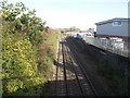
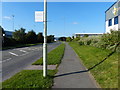
The lifestyle in LE67 1LB is shaped by its proximity to essential amenities within walking or short driving distance. Retail options include five venues, such as Asda Ellistown and Aldi Swinfen Vale, providing access to groceries, household goods, and everyday conveniences. The Shackerstone Railway Station adds connectivity, enabling trips to nearby towns for more specialised shopping or dining. While the area lacks large leisure facilities, the absence of planning constraints means residents can enjoy open spaces without restrictions. The compact nature of the postcode means daily life is efficient, with minimal need to travel far for basic needs. The combination of local shops and transport links creates a self-contained environment, ideal for those valuing simplicity and accessibility. For families, the availability of a primary school and nearby retail options enhances the practicality of living in this small, focused community.
Amenities
Schools
The nearest school to LE67 1LB is Ellistown Community Primary School, which serves the local area with a primary education offering. Its Ofsted rating of “good” indicates a satisfactory standard of teaching and facilities, though no secondary schools are listed in the data. This means families with children may need to look beyond the immediate postcode for secondary education options. The presence of a primary school within practical reach is a key consideration for buyers prioritising ease of access to education. The school’s rating suggests it meets basic expectations for curriculum delivery and student welfare, but parents should investigate further for details on specific subjects or extracurricular activities. Overall, the school infrastructure supports the needs of younger residents, though the lack of higher-level education facilities may influence broader family planning.
| Rank | School | Type | Entry gender | Ages |
|---|
Explore more schools in this area
Go to Schools tabDemographics
The community in LE67 1LB is predominantly composed of adults aged 30–64, with a median age of 47. This suggests a mature population, likely with established careers and families. Home ownership is high at 76%, indicating a stable, long-term resident base rather than a transient rental market. The accommodation type is primarily houses, reflecting a preference for standalone properties over flats. The predominant ethnic group is White, with no data provided on other demographics. This composition points to a cohesive, tightly knit community where most residents are likely to have lived in the area for many years. The low population density of 509 people per square kilometre further supports a quiet, uncluttered lifestyle. While no specific deprivation data is mentioned, the high home ownership and age profile suggest a relatively affluent, settled population with access to essential services.
Household Size
Accommodation Type
Tenure
Ethnic Group
Religion
Household Composition
Age
Household Deprivation
NS-SEC
Explore more demographic insights in this area
Go to Demographics tabPlanning
Planning Constraints
- Flood RiskPremium
- Ramsar Wetland SitesPremium
- Area of Outstanding Natural BeautyPremium
- Protected Nature ReservePremium
- Protected WoodlandPremium