Area Overview for LE67 1ET
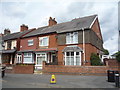
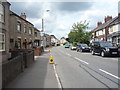
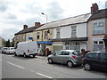
Photos of LE67 1ET


Area Information
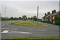
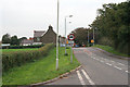
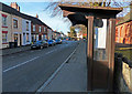
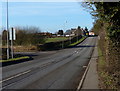
Living in LE67 1ET means being part of a small, tightly knit residential cluster in England. The area covers just 5.4 hectares, housing 2014 people at a density of 345 per square kilometre. This compact postcode is typical of rural or semi-rural settings, where homes are spaced closely but communities remain cohesive. The population skews towards middle-aged adults, with a median age of 47 and most residents falling between 30 and 64. This suggests a stable, established demographic, likely with long-term ties to the area. Daily life here is characterised by proximity to essential services, including local retail and a nearby railway station. The area’s small size means residents are likely to know their neighbours, and the absence of major environmental constraints—such as flood zones or protected landscapes—makes it a practical choice for those seeking a low-maintenance lifestyle without sacrificing safety or connectivity.
- Area Type
- Postcode
- Area Size
- 5.4 hectares
- Population
- 2014
- Population Density
- 345 people/km²
The property market in LE67 1ET is largely owner-occupied, with 72% of homes owned by residents rather than rented. This indicates a community of long-term residents rather than a transient rental market. The accommodation type is predominantly houses, which is unusual for a small postcode area but aligns with the demographic profile of older, family-focused households. This housing stock suggests a demand for spacious, private living spaces, possibly catering to retirees or families seeking stability. For buyers, the small size of the area means competition may be limited, but the concentration of houses could mean fewer options for those preferring flats or apartments. Proximity to a railway station and retail amenities adds to the area’s appeal, though the compact size means buyers should consider immediate surroundings for additional property choices.
House Prices in LE67 1ET
No properties found in this postcode.
Energy Efficiency in LE67 1ET
Residents of LE67 1ET have access to a range of nearby amenities that support a practical, self-sufficient lifestyle. The area is served by five retail outlets, including Aldi Swinfen Vale, Asda Ellistown, and Budgens Shell, providing everyday shopping options within easy reach. The presence of Shackerstone Railway Station adds to the area’s connectivity, enabling travel to nearby towns for additional services or leisure. While the data does not specify parks or leisure facilities, the absence of environmental constraints such as protected woodlands or wetlands suggests that local green spaces may be limited. Nonetheless, the combination of retail, transport, and low-risk assessments creates a setting where daily life is efficient and focused on community needs.
Amenities
Schools
| Rank | School | Type | Entry gender | Ages |
|---|
Explore more schools in this area
Go to Schools tabDemographics
The community in LE67 1ET is predominantly composed of adults aged 30 to 64, with a median age of 47. This suggests a mature, settled population, likely with established careers and families. Home ownership is high, at 72%, indicating a strong preference for long-term residency over rental living. The area is dominated by houses rather than flats, which aligns with the demographic profile of older, family-oriented residents. The predominant ethnic group is White, reflecting a homogeneous community. While specific data on deprivation is not provided, the high home ownership rate and low crime risk suggest a relatively stable socioeconomic environment. The absence of significant diversity data means the area’s cultural makeup remains largely unexamined in public records, but the focus on family-centric housing and low-risk assessments points to a community prioritising security and continuity.
Household Size
Accommodation Type
Tenure
Ethnic Group
Religion
Household Composition
Age
Household Deprivation
NS-SEC
Explore more demographic insights in this area
Go to Demographics tabPlanning
Planning Constraints
- Flood RiskPremium
- Ramsar Wetland SitesPremium
- Area of Outstanding Natural BeautyPremium
- Protected Nature ReservePremium
- Protected WoodlandPremium