Area Overview for LE65 1US
Photos of LE65 1US
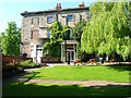
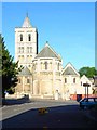
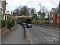
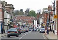

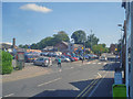

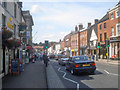
100 photos from this area
Area Information
Key information about the LE65 1US including its size, population, and administrative classification.
- Area Type
- Postcode
- Area Size
- 1.2 hectares
- Population
- 1506
- Population Density
- 986 people/km²
House Prices in LE65 1US
30
Properties
£171,500
Average Sold Price
£22,000
Lowest Price
£295,055
Highest Price
Showing 30 properties
| Address | Type | Beds | Baths | Last Sale Price | Last Sale Date | |
|---|---|---|---|---|---|---|
| 52 Stuart Way, Ashby De La Zouch, LE65 1US | Semi-detached | 3 | 2 | £250,000 | Nov 2024 | |
| 32 Stuart Way, Ashby De La Zouch, LE65 1US | house | 3 | - | £230,000 | Oct 2021 | |
| 11 Stuart Way, Ashby De La Zouch, LE65 1US | Semi-detached | 3 | 1 | £225,000 | Jul 2021 | |
| 34 Stuart Way, Ashby De La Zouch, LE65 1US | Semi-detached | 3 | 2 | £207,500 | Sep 2016 | |
| 24 Stuart Way, Ashby De La Zouch, LE65 1US | house | 4 | 1 | £295,055 | Apr 2016 | |
| 3 Stuart Way, Ashby De La Zouch, LE65 1US | Semi-detached | 3 | 1 | £165,000 | Mar 2016 | |
| 50 Stuart Way, Ashby De La Zouch, LE65 1US | Semi-detached | 3 | 2 | £175,000 | Jan 2016 | |
| 56 Stuart Way, Ashby De La Zouch, LE65 1US | house | 3 | - | £163,000 | Dec 2015 | |
| 36 Stuart Way, Ashby De La Zouch, LE65 1US | house | 3 | - | £196,000 | Sep 2015 | |
| 48 Stuart Way, Ashby De La Zouch, LE65 1US | house | 3 | - | £175,000 | May 2015 |
Page 1 of 3
Energy Efficiency in LE65 1US
Amenities
Schools
| Rank | School | Type | Entry gender | Ages |
|---|
Explore more schools in this area
Go to Schools tabDemographics
Household Size
Family (3-5 people)
most common
Accommodation Type
Houses
most common
Tenure
69
majority
Ethnic Group
White
most common
Religion
N/A
most common
Household Composition
N/A
most common
Age
47
median
Adults (30-64 years)
most common
Household Deprivation
N/A
with no deprivation
NS-SEC
37
in Lower managerial occupations
Explore more demographic insights in this area
Go to Demographics tabPlanning
Planning Constraints
- Flood RiskPremium
- Ramsar Wetland SitesPremium
- Area of Outstanding Natural BeautyPremium
- Protected Nature ReservePremium
- Protected WoodlandPremium