Area Overview for LE65 1TE
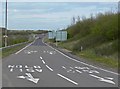
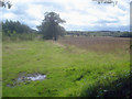
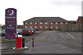
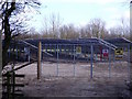
Photos of LE65 1TE


Area Information
Living in LE65 1TE means inhabiting a compact, residential cluster with a population of 1,904 spread across 3.8 hectares. The area’s density—1,350 people per square kilometre—suggests a tight-knit community, though its small size limits the range of amenities. This postcode is part of a broader region with historical roots, though specific landmarks like Ashby de la Zouch Castle are not directly within the area. Daily life here is shaped by its modest scale: residents are likely to know their neighbours, and the local economy revolves around nearby retail hubs. The presence of multiple schools, including Ashby School, indicates a focus on family living. While the area lacks expansive green spaces, its proximity to retail and services offers convenience. For buyers, LE65 1TE represents a niche market—ideal for those prioritising community over sprawl, though its limited housing stock means competition for available properties.
- Area Type
- Postcode
- Area Size
- 3.8 hectares
- Population
- 1904
- Population Density
- 1350 people/km²
The property market in LE65 1TE is characterised by high home ownership (69%) and a focus on houses rather than flats. This suggests a market skewed towards owner-occupiers, with limited rental availability. The small area size—just 3.8 hectares—means the housing stock is constrained, potentially making the market competitive for buyers. The predominance of houses indicates a preference for traditional, family-friendly properties, though the lack of flats may limit options for first-time buyers or those seeking smaller units. Given the area’s compact nature, property values are likely influenced by proximity to amenities such as schools and retail. Buyers should consider the limited supply and the likelihood of a tight market, particularly for properties with specific features like gardens or larger living spaces.
House Prices in LE65 1TE
Showing 1 properties
| Address | Type | Beds | Baths | Last Sale Price | Last Sale Date | |
|---|---|---|---|---|---|---|
| Tesco, Bureau De Change, Resolution Road, Ashby De La Zouch, LE65 1TE | shop | - | - | - | - |
Energy Efficiency in LE65 1TE
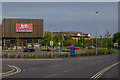
The lifestyle in LE65 1TE is shaped by its proximity to retail hubs, including Tesco Ashby De, M&S Ashby-de-la, and Asda Ashby. These stores provide access to groceries, clothing, and household goods, reducing the need for long trips. The area’s small size means these amenities are likely within a short drive or walk, enhancing convenience. While no parks or leisure facilities are explicitly listed, the presence of multiple retail options suggests a focus on practicality over expansive recreational spaces. The community’s character is defined by its compactness, with daily life revolving around local shops and schools. For residents, this translates to a straightforward, service-oriented existence, though those seeking larger green spaces or cultural venues may need to look beyond the immediate area. The retail diversity ensures basic needs are met, supporting a self-contained, functional lifestyle.
Amenities
Schools
Near LE65 1TE, Ashby School serves as a primary and academy school, with one branch holding an Ofsted rating of ‘good’. The presence of multiple school types—primary and academy—offers families a choice of educational pathways. The ‘good’ rating at one site suggests a generally reliable standard of education, though no data on performance metrics or pupil outcomes is provided. Families with children may benefit from the proximity of these institutions, reducing commuting times. However, the absence of secondary schools in the immediate area could necessitate travel for older students. The school mix reflects a balance between traditional and modern educational models, catering to varying preferences. For parents, the availability of multiple schools is a practical advantage, though the lack of detailed performance data means further research is needed to assess quality fully.
| Rank | School | Type | Entry gender | Ages |
|---|
Explore more schools in this area
Go to Schools tabDemographics
The community in LE65 1TE is predominantly middle-aged, with a median age of 47 and the largest age group being adults aged 30–64. Home ownership is high at 69%, reflecting a stable, long-term resident base. The area is largely composed of houses, not flats, which aligns with the demographic profile of established families. The predominant ethnic group is White, though no specific diversity statistics are provided. The population density of 1,350 people per square kilometre suggests a mix of single-family homes and small households. With no data on deprivation, it is unclear how this density impacts access to services, but the presence of multiple schools and retail outlets suggests basic needs are met. The age profile indicates a mature community, likely with fewer young children than areas with higher birth rates, which may influence local amenities and social dynamics.
Household Size
Accommodation Type
Tenure
Ethnic Group
Religion
Household Composition
Age
Household Deprivation
NS-SEC
Explore more demographic insights in this area
Go to Demographics tabPlanning
Planning Constraints
- Flood RiskPremium
- Ramsar Wetland SitesPremium
- Area of Outstanding Natural BeautyPremium
- Protected Nature ReservePremium
- Protected WoodlandPremium