Area Overview for LE65 1GR
Photos of LE65 1GR
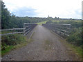
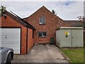
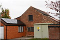
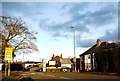
65 photos from this area
Area Information
Key information about the LE65 1GR including its size, population, and administrative classification.
- Area Type
- Postcode
- Area Size
- 11.2 hectares
- Population
- 1289
- Population Density
- 1093 people/km²
House Prices in LE65 1GR
7
Properties
£545,642
Average Sold Price
£370,712
Lowest Price
£690,000
Highest Price
Showing 7 properties
| Address | Type | Beds | Baths | Last Sale Price | Last Sale Date | |
|---|---|---|---|---|---|---|
| Hunters Lodge, 1 Mill Farm Lane, Ashby De La Zouch, LE65 1GR | Semi-detached | 4 | 3 | £592,500 | Mar 2019 | |
| Bayswater House, 5 Mill Farm Lane, Ashby De La Zouch, LE65 1GR | house | - | - | £650,000 | Jul 2018 | |
| Brynmore Mill, 2 Mill Farm Lane, Ashby De La Zouch, LE65 1GR | house | 5 | 1 | £690,000 | Aug 2017 | |
| Leadbury House, 4 Mill Farm Lane, Ashby De La Zouch, LE65 1GR | house | - | - | £425,000 | Jul 2012 | |
| Mulberry End, 3 Mill Farm Lane, Ashby De La Zouch, LE65 1GR | house | 4 | - | £370,712 | Jun 2010 | |
| Mill Farm, Lower Packington Road, Ashby De La Zouch, LE65 1GR | undefined | - | - | - | - | |
| 6 Mill Farm Lane, Ashby De La Zouch, LE65 1GR | office_workshop | - | - | - | - |
Energy Efficiency in LE65 1GR
Amenities
Schools
| Rank | School | Type | Entry gender | Ages |
|---|
Explore more schools in this area
Go to Schools tabDemographics
Household Size
Two person
most common
Accommodation Type
Houses
most common
Tenure
95
majority
Ethnic Group
White
most common
Religion
N/A
most common
Household Composition
N/A
most common
Age
47
median
Adults (30-64 years)
most common
Household Deprivation
N/A
with no deprivation
NS-SEC
53
in Lower managerial occupations
Explore more demographic insights in this area
Go to Demographics tabPlanning
Planning Constraints
- Flood RiskPremium
- Ramsar Wetland SitesPremium
- Area of Outstanding Natural BeautyPremium
- Protected Nature ReservePremium
- Protected WoodlandPremium