Area Overview for LE6 5AS
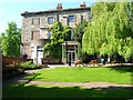
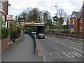
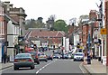
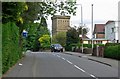
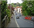
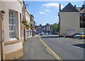
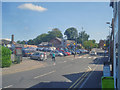
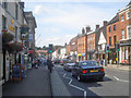
Photos of LE6 5AS


Area Information
LE6 5AS is a small residential postcode area with a population of 1184, characterised by a compact cluster of homes. The area is home to a predominantly middle-aged population, with residents aged 30–64 making up the largest demographic group. This suggests a stable, established community, likely with strong local ties. The high home ownership rate of 76% indicates a focus on long-term residency rather than rental properties, which is typical of smaller, tightly knit areas. While the postcode itself does not directly reference historical landmarks like Ashby de la Zouch, its proximity to nearby amenities such as Co-op stores suggests a practical, everyday-focused lifestyle. Residents benefit from a mix of local services and a relatively low flood risk, though crime rates sit at an average level. The area’s small size means it is well-suited for those prioritising convenience and community over expansive urban sprawl.
- Area Type
- Postcode
- Area Size
- Not available
- Population
- 1184
- Population Density
- 2093 people/km²
The property market in LE6 5AS is dominated by owner-occupied homes, with 76% of properties owned by residents rather than rented. This high rate of home ownership is typical of smaller, less densely populated areas where long-term residency is common. The accommodation type is primarily houses, which contrasts with areas where flats or apartments dominate. This suggests a housing stock that is likely to be older, with traditional layouts and possibly more spacious living environments. For buyers considering the area, the limited size of the postcode means that the immediate surroundings may hold more options, though the overall market is likely to be niche. The focus on owner-occupation also implies that rental availability is limited, which could be a consideration for those seeking investment opportunities.
House Prices in LE6 5AS
No properties found in this postcode.
Energy Efficiency in LE6 5AS
The nearest amenities to LE6 5AS include five retail outlets, with notable examples being Co-op Ashby-De-La and Co-op School. These stores suggest a focus on everyday shopping needs, with access to groceries and basic services. The presence of multiple Co-op branches may indicate a practical, community-oriented retail environment, though the data does not specify other leisure or recreational facilities. The area’s small size likely means that residents can access local shops, cafes, or services without long journeys. However, there is no information on parks, dining options, or cultural venues, so lifestyle choices may be limited to the immediate vicinity. The availability of retail amenities supports a convenient, self-contained lifestyle for those prioritising local convenience.
Amenities
Schools
The nearest school to LE6 5AS is Manor House School, an independent institution. Independent schools typically offer smaller class sizes, specialised curricula, and a focus on individualised education. While no Ofsted rating is provided, the presence of an independent school suggests that families in the area may prioritise private education. However, the data does not include information on state schools or their proximity, so it is unclear whether there is a broader range of educational options. For families seeking a mix of school types, further research into nearby state schools would be necessary. The availability of an independent school may appeal to those seeking alternative educational pathways but may not cater to all household needs.
| Rank | School | Type | Entry gender | Ages |
|---|
Explore more schools in this area
Go to Schools tabDemographics
The population of LE6 5AS has a median age of 47, with the majority of residents falling within the 30–64 age range. This indicates a community that is largely composed of working-age adults and older families, rather than a younger or elderly demographic. Home ownership is high at 76%, suggesting a stable, long-term resident base with fewer transient renters. The area is predominantly composed of houses rather than flats or apartments, which aligns with the typical housing stock of smaller rural or semi-rural postcode clusters. The predominant ethnic group is White, with no specific data provided on other ethnicities, though this does not necessarily imply a lack of diversity—only that it is not explicitly detailed. The age profile and home ownership figures together suggest a mature, settled community with a focus on family-oriented living.
Household Size
Accommodation Type
Tenure
Ethnic Group
Religion
Household Composition
Age
Household Deprivation
NS-SEC
Explore more demographic insights in this area
Go to Demographics tabPlanning
Planning Constraints
- Flood RiskPremium
- Ramsar Wetland SitesPremium
- Area of Outstanding Natural BeautyPremium
- Protected Nature ReservePremium
- Protected WoodlandPremium