Area Overview for LE6 3FB
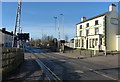
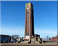
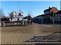
Photos of LE6 3FB


Area Information
Living in LE6 3FB means being part of a small, tightly knit residential cluster in England, where the population of 1832 reflects a modest, stable community. This postcode area is defined by its proximity to Coalville, Leicestershire, with a focus on family-oriented living. The area’s character is shaped by its mix of housing stock, predominantly single-family homes, and its accessibility to nearby amenities. Residents benefit from strong digital connectivity, with a broadband score of 97 and a mobile coverage score of 83, ensuring reliable internet for both work and leisure. The area’s low flood risk and absence of protected natural sites make it a practical choice for those prioritising safety and planning certainty. However, crime rates are above average, which prospective buyers should consider. For families, the presence of two primary schools within practical reach adds to the area’s appeal, while nearby retail options like Morrisons and Spar provide everyday convenience. LE6 3FB is a compact, functional postcode where community needs are met by its size and strategic location.
- Area Type
- Postcode
- Area Size
- Not available
- Population
- 1832
- Population Density
- 2004 people/km²
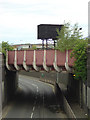
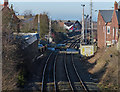
The property market in LE6 3FB is characterised by a 47% home ownership rate, indicating that the area is not heavily dominated by owner-occupied properties. Instead, it appears to function more as a rental market, with a higher proportion of tenants. The accommodation type is primarily houses, which are typically larger and suited to families or individuals requiring more living space. This suggests that the housing stock caters to those prioritising privacy and space over high-density living. Given the small size of the postcode area, the available properties are likely limited, making it a niche market for buyers seeking specific characteristics such as proximity to schools or transport links. The presence of nearby retail and transport options, including Shackerstone Railway Station, may enhance the area’s appeal for commuters or those valuing convenience. However, the limited housing stock means buyers should approach the market with realistic expectations and a focus on specific needs.
House Prices in LE6 3FB
No properties found in this postcode.
Energy Efficiency in LE6 3FB
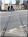
The lifestyle in LE6 3FB is shaped by its proximity to essential amenities, including five retail outlets such as Spar, Iceland Coalville, and Morrisons Hugglescote. These shops provide everyday convenience, from groceries to household items, reducing the need for long trips. The area’s small size ensures that amenities are within practical reach, fostering a sense of self-sufficiency. While the data does not mention parks or leisure facilities, the presence of a railway station and retail options suggests a functional, community-focused environment. The combination of local shopping and rail access supports a lifestyle that balances convenience with the need for connectivity. For residents, this means daily errands are manageable, and the area’s compact nature minimises travel time for routine tasks. However, those seeking extensive recreational or cultural amenities may need to look beyond the immediate postcode.
Amenities
Schools
Residents of LE6 3FB have access to two primary schools within practical reach. Saint Clare’s Catholic Primary School and Saint Clare’s Primary School A Catholic Voluntary Academy both serve the area, offering Catholic education with a good Ofsted rating for the latter. The presence of two primary schools provides families with options, though no secondary schools are listed in the data. This suggests that students may need to travel to nearby towns for secondary education, which could be a consideration for families planning long-term residency. The good Ofsted rating at Saint Clare’s Primary School A Catholic Voluntary Academy indicates a reliable standard of education, which may be a key draw for families prioritising school quality. However, the absence of additional educational facilities highlights the need for proximity to broader educational networks beyond the immediate area.
| Rank | School | Type | Entry gender | Ages |
|---|
Explore more schools in this area
Go to Schools tabDemographics
The community in LE6 3FB is predominantly composed of adults aged 30–64, with a median age of 47. This suggests a mature population, likely with established careers and family commitments. Home ownership stands at 47%, indicating that nearly half of residents rent their homes, which may reflect the area’s role as a commuter hub or a transitional phase for some households. The accommodation type is primarily houses, aligning with the demographic profile of families and individuals seeking more space. The predominant ethnic group is White, which shapes the cultural and social fabric of the area. While no specific deprivation data is provided, the demographic profile suggests a relatively stable population with a focus on long-term residency. The absence of significant age diversity or ethnic plurality means the community may lack the dynamism of more diverse areas, but it offers a cohesive, familiar environment for those who value consistency.
Household Size
Accommodation Type
Tenure
Ethnic Group
Religion
Household Composition
Age
Household Deprivation
NS-SEC
Explore more demographic insights in this area
Go to Demographics tabPlanning
Planning Constraints
- Flood RiskPremium
- Ramsar Wetland SitesPremium
- Area of Outstanding Natural BeautyPremium
- Protected Nature ReservePremium
- Protected WoodlandPremium