Area Overview for LE6 2TY
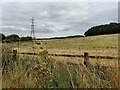
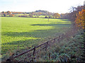
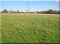
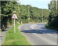
Photos of LE6 2TY


Area Information
Living in LE6 2TY means being part of a compact, residential postcode area in England with a population of 2151 people spread across 509 residents per square kilometre. This small cluster of homes is characterised by a mature demographic, with a median age of 47 and a strong presence of adults aged 30–64. The area’s layout suggests a quiet, settled neighbourhood, where most properties are owner-occupied (76%) and predominantly houses. Daily life here is likely to be low-key, with easy access to local amenities and a low crime risk score of 68. The proximity to Ellistown Community Primary School, rated ‘good’ by Ofsted, and the nearby Shackerstone Railway Station adds practicality for families and commuters. With broadband quality rated excellent (90/100) and mobile coverage good (83/100), residents benefit from reliable digital connectivity. The absence of environmental constraints like protected woodlands or flood-prone areas further underscores the area’s stability. For those seeking a balanced mix of convenience, safety, and community, LE6 2TY offers a snapshot of traditional English suburbia.
- Area Type
- Postcode
- Area Size
- Not available
- Population
- 2151
- Population Density
- 509 people/km²
The property market in LE6 2TY is dominated by owner-occupied homes, with 76% of residents in private residences. This high rate of home ownership suggests a stable, long-term community with limited rental activity. The accommodation type is predominantly houses, which is unusual for areas with higher flat or apartment density. This indicates a market skewed towards family homes or larger properties, likely appealing to those seeking space and privacy. Given the small size of the postcode area, the housing stock is likely limited, making it a niche market for buyers seeking specific properties. The absence of planning constraints or environmental restrictions may also contribute to a straightforward purchasing process. For those considering the area, the focus on owner-occupied housing means competition could be fierce, but the low crime risk and reliable connectivity add value.
House Prices in LE6 2TY
No properties found in this postcode.
Energy Efficiency in LE6 2TY
The lifestyle in LE6 2TY is shaped by its proximity to practical amenities. Local retail options include Aldi Swinfen Vale, Budgens Shell, and Asda Browns, offering everyday shopping needs within easy reach. The Shackerstone Railway Station provides a gateway to broader travel, whether for commuting or weekend trips. While the data does not mention parks or leisure facilities, the absence of environmental constraints like protected woodlands or AONB areas suggests open spaces may be accessible nearby. The compact nature of the area means residents can likely walk or cycle to nearby services, fostering a sense of convenience. The combination of retail, transport, and low environmental restrictions creates a functional, if unadorned, daily life.
Amenities
Schools
The nearest school to LE6 2TY is Ellistown Community Primary School, a primary institution with a ‘good’ Ofsted rating. This school serves the local community, offering education for younger children and likely playing a central role in the area’s social fabric. The presence of a primary school suggests that families with young children are a significant demographic here, though no secondary schools are listed in the data. The ‘good’ rating indicates a satisfactory standard of education, though parents may need to look further afield for secondary options. The absence of additional schools highlights the importance of considering broader educational provisions when evaluating the area for long-term family needs.
| Rank | School | Type | Entry gender | Ages |
|---|
Explore more schools in this area
Go to Schools tabDemographics
The community in LE6 2TY is predominantly composed of adults aged 30–64, with a median age of 47. This suggests a mature population, likely including families and professionals in their middle years. Home ownership is high, with 76% of residents owning their homes, indicating a stable housing market. The area’s accommodation is primarily houses, reflecting a preference for single-family dwellings over flats or apartments. The predominant ethnic group is White, though no specific data on diversity or deprivation levels is provided. The population density of 509 people per square kilometre implies a moderately sized residential area, where social interactions are likely to be frequent. With no mention of socioeconomic deprivation, the quality of life here appears to align with the safety and infrastructure available. The low crime risk score of 68 further supports the idea of a secure, low-stress environment for residents.
Household Size
Accommodation Type
Tenure
Ethnic Group
Religion
Household Composition
Age
Household Deprivation
NS-SEC
Explore more demographic insights in this area
Go to Demographics tabPlanning
Planning Constraints
- Flood RiskPremium
- Ramsar Wetland SitesPremium
- Area of Outstanding Natural BeautyPremium
- Protected Nature ReservePremium
- Protected WoodlandPremium