Area Overview for LE6 2QD
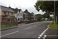
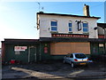
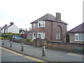
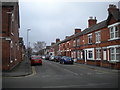
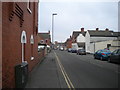
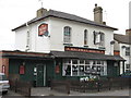
Photos of LE6 2QD


Area Information
Living in LE6 2QD offers a quiet, residential experience within a small cluster of homes. With a population of 2,209, the area is compact but well-served by essential amenities. The community is predominantly composed of adults aged 30–64, reflecting a mature demographic profile. Daily life here balances suburban comfort with practical access to nearby services. The postcode’s proximity to Coalville ensures residents can reach retail outlets, schools, and transport links within short distances. While the area lacks large-scale commercial hubs, its small size fosters a close-knit environment. The presence of a railway station at Shackerstone adds connectivity, enabling commuters to travel further afield. For those seeking a low-maintenance lifestyle, LE6 2QD’s housing stock—primarily owner-occupied homes—offers stability. However, the area’s small footprint means buyers should consider its limited expansion potential. Overall, it suits individuals or families prioritising convenience over urban vibrancy.
- Area Type
- Postcode
- Area Size
- Not available
- Population
- 2209
- Population Density
- 2466 people/km²
The property market in LE6 2QD is defined by a 55% home ownership rate, with houses forming the primary accommodation type. This suggests a community where long-term residency is common, and the housing stock is largely owner-occupied rather than rental-focused. The small area’s limited size means the market is not expansive, but it offers a niche for buyers seeking single-family homes in a low-density setting. The absence of high-rise or apartment blocks indicates a preference for traditional housing. For buyers, this could mean fewer options but potentially higher demand for available properties. The area’s proximity to Coalville may also influence property values, as nearby amenities and transport links can enhance desirability. However, the small footprint of LE6 2QD means buyers should consider the limited scope for expansion or development in the immediate vicinity.
House Prices in LE6 2QD
No properties found in this postcode.
Energy Efficiency in LE6 2QD
Residents of LE6 2QD have access to a modest but functional range of amenities within practical reach. The area includes five retail outlets, such as Iceland Coalville, Spar, and Asda Coalville, offering everyday shopping needs. These stores cater to both household essentials and convenience purchases. The presence of Shackerstone Railway Station enhances mobility, allowing residents to commute to larger towns or cities. While the data does not mention parks or leisure facilities, the retail and transport options suggest a lifestyle focused on practicality and connectivity. The small scale of the area means amenities are concentrated, reducing travel times for daily errands. For those prioritising accessibility over sprawling recreational spaces, LE6 2QD’s proximity to retail and transport hubs provides a straightforward, no-frills approach to living.
Amenities
Schools
The nearest school to LE6 2QD is All Saints Church of England Primary School in Coalville, which holds an Ofsted rating of ‘good’. This institution serves the primary education needs of local children, offering a faith-based curriculum within a community-focused setting. While no secondary schools are listed in the data, the presence of a primary school with a strong rating is a significant draw for families. The school’s location in Coalville suggests it may also cater to students from surrounding areas, potentially increasing its student body size. For parents, the ‘good’ rating indicates a school that meets national standards in teaching quality and student outcomes. However, families requiring secondary education may need to look further afield, as no higher-level schools are included in the area’s immediate amenities.
| Rank | School | Type | Entry gender | Ages |
|---|
Explore more schools in this area
Go to Schools tabDemographics
The community in LE6 2QD is characterised by a median age of 47, with the majority of residents falling within the 30–64 age range. This suggests a population skewed towards middle-aged adults, likely with established careers and family structures. Home ownership rates stand at 55%, indicating a mix of long-term residents and those seeking stable property investments. The predominant accommodation type is houses, reflecting a preference for single-family living. The area’s demographic profile is largely homogenous, with the White ethnic group forming the majority. This composition may influence local social dynamics and community cohesion. While no specific deprivation data is provided, the age profile and ownership rates suggest a relatively stable economic base. For buyers, this demographic stability could translate into predictable property values and a low turnover of residents.
Household Size
Accommodation Type
Tenure
Ethnic Group
Religion
Household Composition
Age
Household Deprivation
NS-SEC
Explore more demographic insights in this area
Go to Demographics tabPlanning
Planning Constraints
- Flood RiskPremium
- Ramsar Wetland SitesPremium
- Area of Outstanding Natural BeautyPremium
- Protected Nature ReservePremium
- Protected WoodlandPremium