Area Overview for LE6 2JL
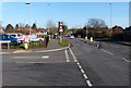
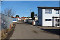
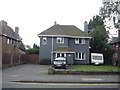
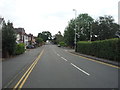
Photos of LE6 2JL


Area Information
Living in LE6 2JL offers a compact, residential experience in a small cluster of homes. With a population of 1,832, the area is characterised by a mature community, where the median age is 47 and the majority of residents fall within the 30-64 age range. This suggests a stable, family-oriented environment with a focus on established living. The area is predominantly composed of houses, reflecting a traditional housing stock that caters to owner-occupiers and renters alike. While the postcode covers a limited geographical footprint, it is well-served by nearby amenities, including a railway station and a selection of retail outlets. For families, the proximity of two primary schools, both with a Catholic Voluntary Academy designation, adds to the appeal. However, the area’s small size means that daily life is closely tied to immediate surroundings, with residents relying on nearby services and transport links for broader connectivity. The broadband quality is excellent, supporting remote work and digital lifestyles, though crime rates are notably higher than average, which prospective buyers should consider.
- Area Type
- Postcode
- Area Size
- Not available
- Population
- 1832
- Population Density
- 2004 people/km²
The property market in LE6 2JL is defined by a 47% home ownership rate, suggesting that nearly half of the housing stock is rented out. This mix of owner-occupied and rental properties indicates a balance between long-term residents and those seeking temporary accommodation. The area is predominantly composed of houses, which are typically larger and more suited to families or individuals prioritising space. Given the small size of the postcode area, the housing stock is likely limited, with properties concentrated in a compact cluster. For buyers, this means competition may be fierce, and the immediate surroundings are critical to consider. The presence of nearby schools and transport links adds value, but the high crime risk could influence property desirability. Buyers should assess whether the benefits of proximity to amenities outweigh the safety concerns.
House Prices in LE6 2JL
No properties found in this postcode.
Energy Efficiency in LE6 2JL
The lifestyle in LE6 2JL is shaped by its proximity to essential amenities. Within practical reach, residents can access five retail outlets, including Spar and Iceland Coalville, offering everyday shopping needs. The Shackerstone Railway Station provides a direct link to the metro network, facilitating travel to nearby hubs. While the area is small, the combination of local shops and transport infrastructure supports a convenient daily life. The absence of larger leisure or entertainment facilities means residents may need to venture further for activities like dining out or cultural events. However, the availability of nearby schools and retail options contributes to a self-contained community feel. The compact nature of the area ensures that amenities are within walking or short driving distance, enhancing accessibility for all residents.
Amenities
Schools
Residents of LE6 2JL have access to two primary schools within practical reach: Saint Clare’s Catholic Primary School and Saint Clare’s Primary School A Catholic Voluntary Academy, both located in Coalville, Leicestershire. The latter holds an Ofsted rating of “good,” indicating a school that meets standards in teaching quality and student outcomes. The presence of two primary schools offers families choice, though both are Catholic institutions, which may align with specific educational or religious preferences. For parents seeking a primary education for their children, the proximity of these schools is a significant advantage, reducing the need for long commutes. However, the data does not provide information on secondary schools or higher education options, meaning families may need to look further afield for comprehensive schooling.
| Rank | School | Type | Entry gender | Ages |
|---|
Explore more schools in this area
Go to Schools tabDemographics
The community in LE6 2JL is predominantly composed of adults aged 30-64, with a median age of 47. This suggests a mature, settled population, likely with established careers and family ties. Home ownership stands at 47%, indicating a mix of owner-occupied properties and rental homes. The accommodation type is primarily houses, reflecting a traditional housing stock that contrasts with higher-density areas. The predominant ethnic group is White, though no specific data on diversity or deprivation is provided. The age profile implies a community with a strong presence of middle-aged residents, which may influence local services and amenities. With no figures on household composition or income levels, the focus remains on the demographic structure, which leans towards stability and continuity. The absence of data on diversity does not imply homogeneity but highlights the need for further contextual information.
Household Size
Accommodation Type
Tenure
Ethnic Group
Religion
Household Composition
Age
Household Deprivation
NS-SEC
Explore more demographic insights in this area
Go to Demographics tabPlanning
Planning Constraints
- Flood RiskPremium
- Ramsar Wetland SitesPremium
- Area of Outstanding Natural BeautyPremium
- Protected Nature ReservePremium
- Protected WoodlandPremium